Category Archives: Technical Lake Stuff

04 April 2013: Bathymetric Survey Data update

It turns out the Clary Lake Sensor Data spreadsheet that we received yesterday wasn’t corrupt, I just couldn’t open an Excel 2007 (.xlsx) file. David Hodsdon was kind enough to convert it to an older more generic Excel file (.xls) and send it to me, and I can open it fine. Before you click on the link, keep in mind that the spreadsheet consists of 3265 rows of data consisting of 21 columns each. Not what you call exciting reading. This is the actual data collected- depth, latitude, longitude, etc.

Clary Lake Sensor Data from bathymetric survey converted to Google Docs format

I’ve posted this document on Google Docs. I’m trying it out as a way of providing fast document access. Let me know what you think. All 3 documents are posted on the Maps Charts & Graphs page, under the Charts and Data main menu heading.

03 April 2013: FOA Request, Preliminary Survey Reaction, odds and ends and end of the day wrap up.

Well it’s been quite a day- a couple of days actually, a lot of activity all of a sudden. Of course, it’s not quite 3pm so it’s entirely likely that something else will land in my lap before dark. Anyways, there are a few things I want to pass on before I forget. First, I received an email from DEP this morning about a FOA request:

The Department of Environmental Protection has received a Freedom of Access Request regarding communications between Department staff and individuals associated with the Clary Lake Level Petition. The records responsive to this request will be available by the end of this week. If you are interested in reviewing the documents, you may make an appointment with the Department’s File Room by calling 207-287-7843.

One has to wonder why, if Pleasant Pond Mill LLC is committed to being relieved of dam ownership, why are they bothering with an FOA request? Perhaps they are just hedging their bets, looking for ways to shoot down our petition. This doesn’t mean they’re not seriously pursuing their own petition for release from dam ownership, does it?

Bathymetric Survey

I have not really had the time to go over the bathymetric survey in detail but my initial reaction is that it is somewhat flawed. More about this when I’ve had a chance to go over the survey and data in detail and have been able to discuss it with some other people.

Ice Out?

 On a lighter note, the ice shelf hugging my shoreline this afternoon finally succumbed to wind and wave action, breaking up and floating away a little over an hour ago. And then just a bit ago a long thin slab of ice drifted in from some place and settled in against my shoreline. It has already broken up and floated away as I type. The only ice left is a bunch of slush that has washed up down at the far east end of the lake. From other reports I’ve gotten from others around the lake and what I’m seeing out side my window now, David Hodsdon will be hard pressed not to call ice out today, 03 April, 2013.

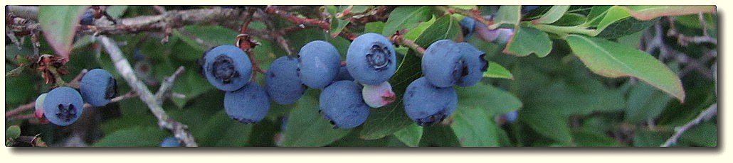
User Picture Submissions

Finally to wrap up this post, Trudi Hodgkins sent along a couple of recent pictures which I have posted in the User Uploads- Clary Images gallery. They should be showing up auto-magically in the “Recent Pictures” box in the side bar as the gallery default sort is by date, descending i.e., newest pictures at the front (or top?) of the gallery. And here, to the left and the right, are the thumbnails. So you don’t have to hunt around for them. Thanks Trudi!

I’m done.

03 April 2013: DEP Releases Bathymetric Survey Results

True to their word, DEP, in accordance with Procedural Order #5 of Department File #L-22585-36-B-N, Clary Lake Water Level Petition, have released the data and results from a bathymetric survey conducted by the Department in September 2012. I’ve barely had a chance to look at this myself. Of  the files sent, the main document you’re going to want to download the depth/contour map:

Bathymetric Survey Contour Map

I’ve barely had a chance to look at it myself. They also sent along 2 other files including a spread sheet which appears to be corrupt (I’ve been unable to open it) and another aerial photo of the lake showing the point coverage of their data collection; it’s a very large (4+ megabytes) file so I won’t try to display it. I suggest you right click on the link and select “Save as”:

Clary-Lake-Depth-Points.pdf

I’ll post the spreadsheet for download when they send me a viable copy. They also sent along a revised Service List which you’re welcome to download if you wish. I wouldn’t bother, unless you’re on it 🙂

Pursuant to Procedural Order #5, parties may submit written questions or comments on the data no later than April 17, 2013.  Questions or comments must be copied to all parties on the Service List.

31March 2013: End of Month Summary

 I’ve posted the final March 2013 water level chart. For the month, we got a paltry 1.22″ of precipitation which nonetheless brought the lake up a total of 17.78″ (runoff multiplier of 14x!) from where it started the month at -55.68″ below the top of the dam to -38.76″ below the top of the dam on March 18th. It has fallen only 2.5″ since then. The reason the lake rose so much from so little rain is because lake is so much smaller due to the low water level: when it rains, the water level really has nowhere to go but up. For comparison, when the lake is around 40″ below the top of the dam (where it is now), rising water tends to spread out over the drained wetlands, increasing the surface area but the water level, not so much.

30 March 2013: A lot like spring out there today, and other thoughts

Gorgeous day out there today, I’d say most of the north side of the lake is ice-free, perhaps about 1/4 of the lake total- enough so that open water is now easily visible on the web cam from over here on the south shore.

 David Hodson and I stopped over yesterday afternoon take a look around and bumped into Doug Kinney. He said there’d been a pair of loons hanging around. Sure enough, we soon spotted one loon but it was too far off for me to get a picture. It is the earliest I’ve ever seen loons back on the lake. There were also plenty of other water fowl out swimming or wheeling overhead. At the rate ice is disappearing, I expect the lake will be ice-free within a week. Lousy weather could complicate that.

I’d like to thank those of you who corresponded with me about the recent article in the Lincoln County News. No, I don’t think Butch’s plan to have the dam removed stands a chance of happening; it’s just silly, as is his idea of “farming” the meadow. In the old days folks likely pastured some cows out there part of the year when it wasn’t flooded, and we know they cut meadow hay during a short window of opportunity in the early summer, but that’s about the extent of the “farming” that took place in Clark’s Meadow. We all know why Butch would like the water level kept low- his reasons are purely selfish. I will be sending a letter to the editor next week.

Some of you may have noticed that I went ahead and converted all the old legacy photo albums to new WordPress NextGen albums. I hadn’t planned on doing that but it turned out to be pretty easy. They offer more utility and convenience and do a better job of displaying pictures. Sadly, they don’t handle documents like PDF files of which there are a boatload on the site. I’ll have to look for another solution to manage and maintain those.

Finally, I stopped by the dam this afternoon to measure the outflow from the lake; came up with a figure of 35 cubic feet per second which is about what is expected with the lake level 40″± below the top of the dam. Have been wondering if there’s a way to estimate Clary outflows with any degree of accuracy using flow data from the USGS Sheepscot river gauging station located at the bottom of Grand Army Hill. More on this when I find some spare time.

Reminder: This coming Wednesday the 3rd DEP is supposed to distribute the results of the bathymetric survey they performed last September. Stay tuned 🙂

HOW MANY SPRINGS ARE THERE AROUND CLARY LAKE?

Clary Lake Spring hole_DH11919     This is a large spring hole  out in front of my property.  with the lake level as low as it is, there is more opportunity to observe springs in the lake.  I also have observed 4 or 5 more along the immediate shore.  It has prompted me to wonder how many more there are around the lake.  So, how about looking out in front of your property and report on any that you see.  It will help in George’s and my efforts to understand more fully the dynamics of lake level variations. David

21 February 2013: Resumed Water Level Measurements, Etc.

With the warming trend and melting snow of late, I resumed making water level measurements  yesterday but with the snow storm due in this weekend I suspect I’ll knock off again for a while. I had to remind myself the other day why I’m making water level measurements: primarily I am interested in modeling the complex hydrological system that is Clary lake.  With its variable inflows from runoff and ground water and variable outflows depending on the status of the dam’s gate, how the lake rises and falls at any given time is anything but obvious.  There’s a lot to ponder and a lot to learn.

More pictures

Jane Chase has given me some more pictures that I will scan and add to the Chase Family Archive when I get a chance. Also, Colin Caissie has given me a CD full of photographs he Colin Caissie cross country skiingtook last week while cross country skiing down the channel to the dam. He is particularly concerned about the impact that ice flows are having on the shoreline: as result of the historically low water levels, ice flows are  plowing up soil,  sediments, and sensitive wetland vegetation around the lake. This has already resulted in erosion and sedimentation of the waters of Clary lake as well as the Sheepscot river, a serious condition that will accelerate this spring when ice and snow melts and outflows increase. If you will recall, I expressed similar concerns in a recent post with accompanying photographs in the Winter 2013 album. I’ll post some of Colin’s pictures soon.

18 February 2013: Suspending Water Level Measurements

I’m suspending water level measurements for a while- I went down to the lake this afternoon and just didn’t have it in me to dig through 3′ drifts of snow for 40′ to get out to where the water is. I’ll resume when it warms up a little and some snow melts. At last measure 2 days ago, the lake was down to 145.94′ or -56.40″ below the top of the dam.

Still no word from the DEP on a decision. It’s been 14 days since Senator Chris Johnson talked to Jerry Reid at the District Attorney’s office. It was suggested at that time that if we might hear something “in a couple of weeks.” I’ll look into getting an update later this week if we haven’t heard anything.