Category Archives: Technical Lake Stuff

14 September 2013: It’s been down so long it looks like UP to me!

Current Month Water Level Chart

Heavy rains over the past few days have brought the lake up 14.6″ so far from it’s low back on August 30th, most of the rise have occurred in the last 3 days. As of 7 AM this morning, the lake was at an elevation of 147.23′ or 40.92″ below the top of the dam. It’s still rising fast as the ground is saturated and the rate of runoff is high. Peak runoff typically occurs 24 hours after the end of the rain event which will be sometime tomorrow. Judging from the rate of rise in the last 24 hours and the trajectory of the curve I would expect to see the lake rise another 6″ or 8″ over the next couple of days and I wouldn’t be surprised if more than 50 cubic feet per second of water flowing out of the lake by Monday morning. Check out the Water Level Charts and guestimate for yourselves how high the lake will get.

The rapidly rising water has likely caught a few people by surprise, myself included. I woke up this morning to find my dock (which is sitting on stilts) barely above water and the ramp leading to it had floated away. I’ll be out later today searching for it and will have to move my dock in closer to shore lest it too float off in the night. Other people with moored docks and floats might find them inaccessible for the time being. On a brighter note, there were a number of people who were facing the predicament of getting their boats out of the lake. This lake level rise should make it easier. Currently at the state boat launch there’s 1.7′ of water over the foot of the ramp- still less than the design value of 2.3′ but a lot better than it has been. Tomorrow afternoon I would expect the there to be at least 2′ of water over the foot of the ramp if not more. Here’s your chance folks.

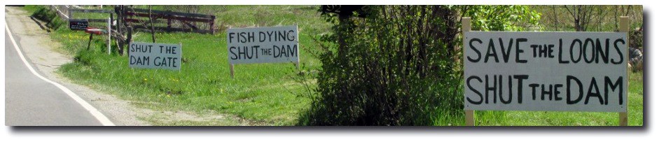
As welcome as this water level rise is, it’s important to note that the lake is still drastically low. At 40″ below the top of the dam the Great Meadow is still devoid of water and the vast wetland will offer no welcome haven to the flocks of migrating water fowl looking for a place to lay over, later this month. I’m not exactly sure how much rain we received over the past 3-4 days but we’re approaching 6″ total so far for the month, and it’s not even the middle of the month. Kelley is going to wish he had made repairs to the dam while he had the chance.

30 July 2013: [UPDATED] Clary Lake has officially entered an algae bloom state

img_2331__medium_David Hodsdon and Jack Holland completed their routine water quality monitoring task yesterday. I have updated the Clary Lake Water Monitoring Data page. David reports that the secchi disk reading he obtained yesterday (4.92′ or 1.5 meters) without question indicates that Clary Lake is experiencing an algae bloom, a fact that should not come as a surprise if you’ve been out on the lake lately. A lake is considered to be experiencing an algae bloom when the secchi disk reading is at or below 2 meters (6.56′). We’re well into bloom territory.

David has been in touch with Scott Williams of the VLMP about this issue and they may be sending someone out to independently assess the situation. The picture at upper left is from last summer’s bloom. It hasn’t gotten that bad yet.

I’ve written recently about algae blooms (here and here) and why we’re more at risk now because of the extreme low water conditions we’re experiencing. I’m going to get on the phone and rattle some cages.

anabena2 [UPDATE]: I took a ride around the lake this afternoon- with bright sun shining down, I could just barely make out the bottom in 3.5′ of water off the end of my dock. I took a water sample just a bit ago and examined it under a microscope: it is loaded with Anabena cyanobacteria, the blue-green algae pictured at left that is largely responsible for freshwater algae blooms. The transparency of the lake water has deteriorated seriously over the last month: On the 1st of June the secchi disk reading was 10.1 feet; by the 19th it had dropped 2 feet and in the last 10 days dropped another 3 feet. Transparency is now less than 1/2 of what it was a month ago. They’re multiplying. Fast.

02 July 2013: Clary Lake Watershed Survey Base Map is Online

M watershed_with_topoI’ve put together a Clary Lake Watershed Survey Base Map using Google Maps and watershed boundaries from the Maine Office of GIS for Clary Lake and Three Corner Pond. The map is basically a proof of concept effort, and a work in progress to boot as I’m still learning how to fit all the pieces together. The next step will be to put the 90 or so records of NPS (non-point-source) pollution sites from the original 2001 watershed survey into a database, geo-reference them with latitude and longitude, add pictures and updated information where necessary, and then finally, import them into the map. Continue reading

01 July 2013: [UPDATED] Whitefield and Jefferson Parcel Maps for Google Earth

googleearthIf you’re anything like me, you’ve been annoyed that the Maine office of GIS has not updated it’s Google Earth Parcels.kml file to include the recently completed Whitefield parcels map file. Whitefield parcels have been available for a while as a shape file, but that’s no help unless you have Arcinfo or Arcview. If you wanted to view Whitefield parcels in Google Earth, you’ve been out of luck.

No longer! I managed to get my hands on both Whitefield and Jefferson parcel maps. No need to load in every organized town in Maine, you can just load in the town you want. We’ll be making use of these when we get to work on updating the Clary Lake watershed Survey:

These links will open up in Google Maps. To add them to Google Earth, download them to your computer, then open them in Google Earth and save them to “My Places”. I’ll likely put these under the Charts & Data main menu heading at some point for easier downloading.

[UPDATE] I’ve also separated out the KML files for the Clary Lake watershed and the Three Corner Pond watershed (which flows into Clary Lake):

Clary Lake and Three Corner Pond Watershed (kml) file

These too will be useful when we get to updating the Clary Lake Watershed Survey. Like the Parcel files, these will open in Google Maps. Just download them and open them up in Google Earth, save them to “My Places.”

30 June 2013: Month-end Water Level Summary

6 June 2013June was the second month in a row with significantly above-average rainfall and this has helped keep the lake level up despite the dam owner draining 1.2″ of water out of it each day. It was the 6th wettest June in recorded history! We received approximately 6.13″ of rain, a good 2.6″ more than the average for the month of 3.56″. We started the month at -32.16″ below the top of the dam, fell to a low of -46″ on the 25th and then heavy rains brought it back up 5.5″ to 40.44″ at the end of the month. It we’d received the average rainfall for the month the lake would be at least a foot lower than it is today. It looks like this higher-than-average rainfall trend is going to continue for a little while; I’m torn between wanting more rain to offset the falling lake level and less rain to accommodate more outside activities.

Continue reading

28 June 2013: The Clary Lake Watershed Survey and the NPS program

M mapclarylake_with_watershedBack in 2001 members of the Clary Lake Association with the assistance of some DEP staff conducted a watershed survey to identify and catalog sources of non-point source pollution. Typically these were areas where soil was eroding and running into the lake: road side ditches, road shoulders, driveways, unprotected shorelines, unstable slopes, clogged, poorly maintained, or improperly installed culverts, etc. Money for erosion control measures was available under the State’s Nonpoint Source Water Pollution Control Grants (“319”) program. 90 sites were identified and categorized as to whether they were Low, Medium, or High priority and a grant was obtained and erosion control measures were implemented at a number of the high priority site

The NPS pollution and “319” grant program is still in existence today. At this summer’s Congress of Lake Associations’ 43rd Annual Maine Lakes Conference held last Saturday the 22nd at Colby College which I attended, Norm Marcotte of DEP gave a short presentation on DEP’s new NPS Tracker Program which is basically like the old NPS program with added spreadsheet functionality and computer mapping features made possible by such programs as Google Earth and Google Maps.

Continue reading

26 June 2013: Rain! [UPDATED THRICE!]

26june2013radar_mapYou know it’s a slow news day when all I got to write about is rain but I’ve been doing a rain dance daily for a while now and it is finally paying off. This afternoon a beautiful storm cell formed up and moved in over Clary Lake and sat there. It’s still there. I just checked my rain gauges (a coffee cup and a dog food can out in the yard) and we’ve already received 1.375″ of rain and it is still raining steadily and shows no sign of letting up. The ground is pretty well saturated so I expect a good amount of runoff on top of yesterday’s rain… and more wet weather is forecast for the next couple of days. Keep an eye on the Current Water Level Charts.

[UPDATE 1] We ended up getting 1.5″ of rain out of that storm. Channel 6 weather report is calling for heavy rains tomorrow, as much as 2-3″

[UPDATE 2] Both David Hodsdon and Tim Chase got more like 0.9″ of rain out of yesterday’s storm, leading me to believe my 1.5″ measurement included “splash” since the rain was coming down pretty violently for a while. Certainly, 0.9″ of rain is more consistent with the lake level rise I observed this morning. I’ll be revising my rainfall amount and altering my make-do rain gauge setup.

[UPDATE 3] Don Norman called to tell me the he too got 1.5″ of rain yesterday. I guess that’s the meaning of “locally higher amounts.” I suspect that the total average rainfall, judging from the lake level rise, was between 1″ and 1.5″

17 June 2013: Temporarily Broken Subsystem

confused-monkey1The water level chart update mechanism is broken. I’d hoped to get it fixed over the weekend but I guess I have to write a new script and I really don’t have the time right now. Sorry for the inconvenience. I’ll fix it when I get a chance. In the meantime, if you want to know what the water level of the lake is, go out and take a look!

UPDATE: Temporarily Broken Subsystem Permanently Fixed. I guess it wasn’t really broken in the first place.

01 June 2013: May Month End Summary

5 May 2013May started out dry but turned into a wet month indeed. On top of a dry April, we received no rain at all for the first 8 days of the month. The lake level started out -46.44″ below the top of the dam and fell at the average rate of 0.6″ per day to -56.52″ by the 17th of May at which point the dam’s gate was closed. Over the next 12 days we received 5.68″ of rain which brought the lake up 25.52″ for a runoff multiplier of 4.5x (4.5″ rise for each inch of rain) which is about what was expected. We ended the month at -31.08″ below the top of the dam. Average rainfall for May is 3.6″. The gate was reopened on the 27th and opened even further on the 30th. Runoff from the May rains has finally diminished to the point where the lake level has started falling again, having fallen just over 1″ as of this morning.

26 May 2013: The rain has ended!

swimmingThat was quite a stretch of wet weather eh? This afternoon as the sun started to break through I marveled at how long it has been since I’ve seen it, and how much rain we’ve gotten this month. April was a very dry month and May started out just as dry with no rain for the first 8 days. Since then we’ve received 5.5″ of rain which has so far brought the lake up 21.6″ with most of the rise occurring in the last 5 days. This afternoon the lake level sits at 34.9″ right at the bottom of the hole in the dam. As of this afternoon there was no water coming through the hole but as the lake continues to rise over the next few days that will change.

In any case, get out there and enjoy the (relatively) high water while it lasts. The lake hasn’t been this high since late June last summer and there’s no telling what to expect as the summer advances. The State boat launch is usable now and if you’re careful you won’t have any trouble getting your boat in the water. There’s 2.1′ of water over the foot of the ramp which is just a little shy of the design specification of 2.3′. Be mindful of the rocks- the water is only about 12″ deep 20′ off the end of the ramp.

I thought Kelley was going to open the gate this weekend in an attempt to keep the water level below the hole in the dam as he did last summer but he hasn’t touched it. Surprise, surprise. Last year he was ostensibly concerned about the impact of high water on the integrity of the dam and he did everything he could to keep the level -40″ or more below the top of the dam. Now maybe everything has changed; he has been referring to the dam as the “breached dam that formerly impounded Clary Lake” as if he’s given up on the useless, broken relic. Still, he’s trying to sell it and you’d think he’d want to keep it from deteriorating further especially considering he’ll probably still own it, and have to fix it, when the lake level order goes on.

Happy Memorial Day everyone.

24 May 2013: Lake Level is UP

It isn’t often that I update the water level charts more than once a day but I did this day, the water was coming up so fast you could almost watch it rise. The lake has come up a little more than 12″ since last Monday when it started raining, rising from -56.52″ below the top of the dam to -44.16″ earlier this afternoon and they’re forecasting rain for a couple more days too so the lake isn’t done rising by a long shot. Runoff was limited at the start because most of the rain soaked into the dry ground rather than running off into the lake the ground is now saturated and runoff rates are more or less normal now.

You’ll notice a new feature on the water level charts: a straight black line across the chart at an elevation of -34″ below the top of the dam which is the approximate elevation of the bottom of the hole in the dam. When the water rises above this level it will start pouring through the hole. Last year Kelley did everything he could to keep the lake level below -40″ to prevent enlargement of the hole, causing further damage to the dam. If he keeps up this practice this year, expect him to open the gate this weekend.

15 May 2013: Clary Lake Water Monitoring Data Now Online

secchi_diskWe’ve finally gotten around to putting current Clary Lake water monitoring data online. It’s a subset of the data collected by David Hodsdon and Jack Holland and will be updated roughly every 2 weeks from early spring through late fall or as often as David and Jack get around to it. What’s online now includes all the data from 2012 and what’s been collected so far in 2013. That little thumbnail at left is what a secchi disk looks like- it’s used to measure the transparency of the water.

I hope to get some historical data online soon; there’s quite a bit of it. David has been collecting water quality data on Clary Lake since 1975, Jack Holland since about 2001. Both are certified volunteer water quality monitors. Here’s a typical data sheet from a data collection session and here are 3 charts based on the collected data. Graphing the data is helpful because it allows you to see trends in the data that aren’t necessarily obvious from just looking at it. One disturbing trend evident from the secchi disk chart is that the transparency of the lake water has deteriorated markedly in recent years. This trend also coincides with the increase in phosphorus evident from the Total Phosphorus chart. We’ll be talking more about these trends in the near future.

Last spring I accompanied David and Jack on one of their regular water quality monitoring sessions and have put together a short photo gallery of that session: “Our Water Quality Monitors at Work“.

13 May 2013: How Low Can It Go?

Some of you will remember seeing a table something like this last year, on the old site:

Lake Rate of Fall With Dam’s Gate Full Open
Inches Below Top of Dam  Rate of Fall in 24 Hours
 0″ to 36″  1″
 36″ to 48″  3/4″
 48″ to 62″  1/2″
 Below 62″  1/4″ or less

These figures were derived empirically which simply means these are based on measurements we made and recorded. They are what they are. They’re averages and on any given day they will likely vary a little or (even a lot) due to changing conditions: lake surface area, the shape of the lake, and most important, the amount of runoff from rain or snow melt. But all things being equal, these numbers should be pretty close most of the time.

Which brings me to the reason for this post: the question of how low can the lake get. I have in the past come to the conclusion that the rock-bottom low water level was from-hydrographic-surveysomewhere around 6 feet (-72″) below the top of the dam. This figure was arrived at after measuring the water depth at the mouth of the channel at the northwest end of the lake. I also came across a fascinating book entitled “The Water Power of Maine” by Walter Wells, first published in 1869. In it I found a table that I’ve reproduced the table at left. It estimates the additional storage in Pleasant Pond (now Clary Lake) as 4 to 6 feet. Coincidence? I don’t think so.

Yesterday afternoon Colin Caissie and I went over to look a the narrow gauge rail road abutments to assess their suitability for the construction of a coffer dam. To get the colin_at_rr_abutmentdistance between the abutments, I waded across the channel (and filled my boots in the process) while dragging a tape measure and found the center of the channel to be 2′ deep. The water level at the time was -54″ below the top of the dam. Adding 24″ to this gives you an elevation of the center of the channel between the abutments of -78″ or -6.5 feet below the top of the dam. The average distance between the abutments by the way is 16.5′. There are more pictures from this adventure in the Spring 2013 gallery.

And there you have it folks. The lake can’t possibly fall more than 6.5′ below the top of the dam and chances are, since there is a gentle slope to the channel on the order of about 1/2 a foot over it’s entire length, the limiting factor likely is the elevation at the entrance of the channel. So if anyone asks you how far the lake can fall, tell `em “6 feet.”

The lake is down -54″ now. It can fall another 18″. Last spring it reached -63″ below the top of the dam. At the rate the lake is dropping, we’ll get there again in 10 days.

09 May 2013: Petitioner’s Comments on Clary Lake Assessment (minimum flows recommendation)

bam-customI have just submitted my comments on the Clary Lake Assessment (minimum flows recommendation) which was one of the two documents included in the ADDENDUM to the bathymetric survey released by the Department on 09 April 2013. I’m not sure my comments are really worthy of a BAM! thumbnail but it seemed appropriate. This is the 3rd submission this week. A short 3-word summary of my position on the new Clary Lake Assessment: Almost Good Enough:

Petitioner’s Comments on Clary Lake Assessment (minimum flows recommendation)

Here’s the revised Clary Lake Assessment if you want to follow along. The other document in the release were comments by the Maine Emergency Management Agency regarding their hazard classification of Clary Lake dam. I wasn’t going to submit comments on them, but they’ve sure got Paul Kelley’s undies in a bunch so maybe I’ll take advantage of the 30 extension to the comment period and write something up.

07 May 2013: New Water Level Chart finds a home.

Water Level Chart from December 2011 to the Current Date

I’ve  decided this new water level chart will live on the Current Water Level Charts page along with the Year to date chart and the Current Month chart. All 3 charts are updated daily. It’s become a ritual.

This chart has garnered a lot of attention since I first posted it yesterday morning. It had quite an impact on me and apparently on many other people too.

06 May 2013: A Year and a Half of Water Level Records

I got to wondering what a water level chart showing all the water level data I have collected since the 19th of December 2011 to today would look. The result isn’t pretty:

water_level-small

With the exception of May and June of last year and a few days in March and early April this year, the lake has been lower than -40″ below the top of the dam since I started keeping records. It will take a long time for the wetlands to recover from being “ravaged” to use a term Mr. Kelley seems to like so much.

I’ll update this graph periodically. I haven’t decided where it will live.

17 April 2013: Petitioner’s Comments on Clary Lake Procedural Order #5: Bathymetric Survey

16: 4-30-1967-bw-aerial-8pctThis afternoon I completed and emailed my comments on the bathymetric survey to the Service List. My response consists of 2 files, a 6 page letter and an appendix with 18 photographs. Because the appendix is large (2.3 megabytes) I’ve added it to Google Drive and have provided links below. At this point I doubt anyone else is going to submit comments on the survey but I remain prepared to be surprised. I’ve posted the documents at these links:

The photographs included in the appendix are also available for viewing and download (with descriptions somewhat truncated for online formatting) here:

It pained me to take issue with the Department’s survey results.

Google Drive Links if the above give you trouble:

09 April 2013: Thoughts on the new Minimum Flows Recommendation

The new Minimum Flows Recommendation (see Clary Lake Assessment 3-Apr-13) gives me pause for thought.

First, I’m not quite sure how they came up with this- it appears to be based in large part upon section 6 of Chapter 587, the Standard Allowable Alteration method of determining required water levels in Class GPA (Great Pond Act) waters which however discriminates between a 1′ draw down from April 1st through July 31st and another 1′ draw down (for a total of 2′) between August 1st and March 31st as opposed to a total maximum draw down of 2′.

Second, the document quotes some numbers from the bathymetric survey (the figures 17% of the total lake volume and 14% of the total lake surface area come directly from the data table) but does not arrive at a draw down corresponding to the 25% volume reduction or the 25% area reduction. I’m not complaining, but why? Are they perhaps aware of problems with the modeling of the wetland area?

Third, and I’ve already mentioned this in response to David Hodsdon’s comment on another post, they suggest that the figures they’ve come up with are ONLY intended to protect the main basin of the lake:

Recommended within basin water levels are protective for the maintenance of suitable Water quality, resident fish and Wildlife habitat, and prevention of shoreline erosion. However, it is quite apparent that significant dewatering of valuable Wetland habitat will result in the vicinity of the outlet stream, above the dam.

What’s up with that? One can’t lower the water level in the basin without also lowering the water level in the marsh. How can a 2′ draw down be protective of water quality, resident fish and Wildlife habitat, etc., and yet contribute to “significant dewatering of valuable wetland habitat”?

This sentence is a new addition to the minimum flows recommendation they prepared a year ago.

Fourth and finally, they list minimum outflows which must be met unless inflows are less. How are we supposed to measure inflows? I assume if you’re letting water out and the lake is not falling, then inflows equal outflows. If you’re letting water out and the lake is falling, then outflows are greater than inflows. Finally, if you’re letting water out and the lake is rising, you’re not letting out enough water. This hit-or-miss approach seems amateurish and error prone. Surely there is a better way!

There is: We install a top weir in the dam with stop logs at some level such as 12″ below the top of the dam and walk away and let mother nature take care of it. I wonder what they’ll think of such a plan.

It is also interesting to note that the minimum flow figures are identical to those published a year ago.

Filed under Petition News and Technical Lake Stuff with a hint of Editorial.

09 April 2013: DEP Procedural Order #5 Bathymetric Data – ADDENDUM

Just received this email from Beth Callahan:

Per the directive of the Presiding Officer, the attached documents are being sent to you for your review and comment. Parties may submit written questions or comments on the documents no later than May 9, 2013.  Questions and comments must be copied to all parties on the Service List. If additional time is needed to review the documentation, please send your request for additional review time along with a reasonable alternative submittal date to me no later than May 6, 2013, and copy all parties on the Service List.  Subsequently, the attached documents and all comments received will be added to the administrative record of the Clary Lake Water Level Petition, #L-22585-36-B-N.

The first document contains comments from the Maine Emergency Management Agency regarding the Clary Lake Dam’s current hazard classification.  The second document is a revised minimum flow recommendation submitted by the Department’s Division of Environmental Assessment.  This recommendation is based upon the regulations outlined in the Department’s Chapter 587 for Instream Flow and Lake and Pond Water Levels and also the data gathered from the Department’s September 2012 bathymetric survey of Clary Lake.

The Attached documents:

  1. Maine Emergency Management Agency Comments 8-28-12
  2. Clary Lake Assessment 3-Apr-13
  3. New Service List dated 9 April 2013

I’ll comment as soon as I’ve had a chance to review the material.

07 April 2013: Preparing Petitioner’s Response to DEP’s Bathymetric Survey

I’ve finished my assessment of the bathymetric survey and have begun preparing my comments. I wish I could tell you that that survey is fantastic and I love it. I cannot. I feel that it is deeply flawed. As a (retired) Maine Professional Land Surveyor I am perhaps uniquely qualified to evaluate the survey, having made (and checked) numerous contour maps over the years both directly from data collection to finish drafting and indirectly by establishing horizontal and vertical control for large mapping projects involving aerial photography. I know what to look for and I know what I’m talking about.

I’ll leave it there for now. I’d like the Department to read about my allegations directly before I post anything publicly. Theoretically I have until the 17th of April to submit comments on the survey but I’d really like to get them in the mail tomorrow. I’ll upload it here as soon as I’ve sent it out.

On another note, David Hodsdon combined the Clary Lake depth points document with the bathymetric survey in one convenient and easy-to-view jpeg image which I’ve uploaded to Google Drive. Thanks David. I’ll post it to the Maps Charts & Graphs page later.