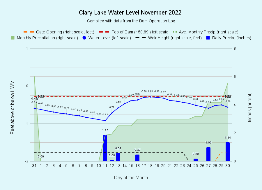
I have archived the November water level chart (at left). Our plan at the beginning of the month had been to start dropping the lake to it’s early winter level around 14”-16” below the HWM. November is actually the month with the highest rainfall with an average of 4.58 inches but the first 10 days of the month were rain-free and we really didn’t know what to expect for the rest of the month so we didn’t take any drastic management actions, preferring to let the lake find it’s own happy level. Then the rains started first with a 1.85” rain event on the 11th followed by several more rain storms over the next 5 or 6 days which brought the lake level back up to the top of the dam by the 18th. On the 23rd we pulled the last two stop logs out of the weir and the lake level started dropping again, but two more large rain events towards the end of the month (1 inch on 27th and 1.34 inches on the 30th) brought us to 5.53 inches for the month and despite having opened the gate ¾ of a foot, the lake level rose back up to the top of the dam. We ended the month with a full lake and a full inch above November’s average rainfall. This brings us to 44.29 inches for the year to date, 3.67 inches more than average. Needless to say, the drought is over for this year.
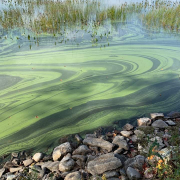
 The extraordinary algal bloom that plagued our lake in September and October finally started to burn itself out by mid November as the water temperature dropped and the algae began to run out of food. That plus shorter days with reduced sunlight finally brought the bloom to an end. We’ll continue analyzing the circumstances that caused Clary Lake to bloom so spectacularly this year, but simply understanding what happened isn’t going to prevent it from happening again. This coming year the CLA intends to start work on updating its 2001 Watershed Management Survey to find and fix sources non-point source pollution in our 9.9 square mile watershed. “Non-point source pollution” is just a fancy way of referring to soil erosion and sedimentation resulting from runoff from rainfall which makes it’s way into Clary Lake on it’s way to the ocean. Phosphorus is plant food and it fuels algae growth like nobody’s business, and runoff with sediment from erosion is the primary (but not the only) source of Phosphorus entering Clary Lake. Reducing the introduction of sediment into our lake is the one way we can actually do something about algal blooms. Clary Lake will bloom again, that’s for certain. Our hope is that we can take steps to reduce the severity of future blooms, and shorten their duration.
Updating our watershed management survey will involve a lot of work and require a lot of help. Planning is starting soon, and actual fieldwork will start in the Spring. If you’re interested in getting involved in this important initiative, send an email to George Fergusson or use our handy Contact Form.

