
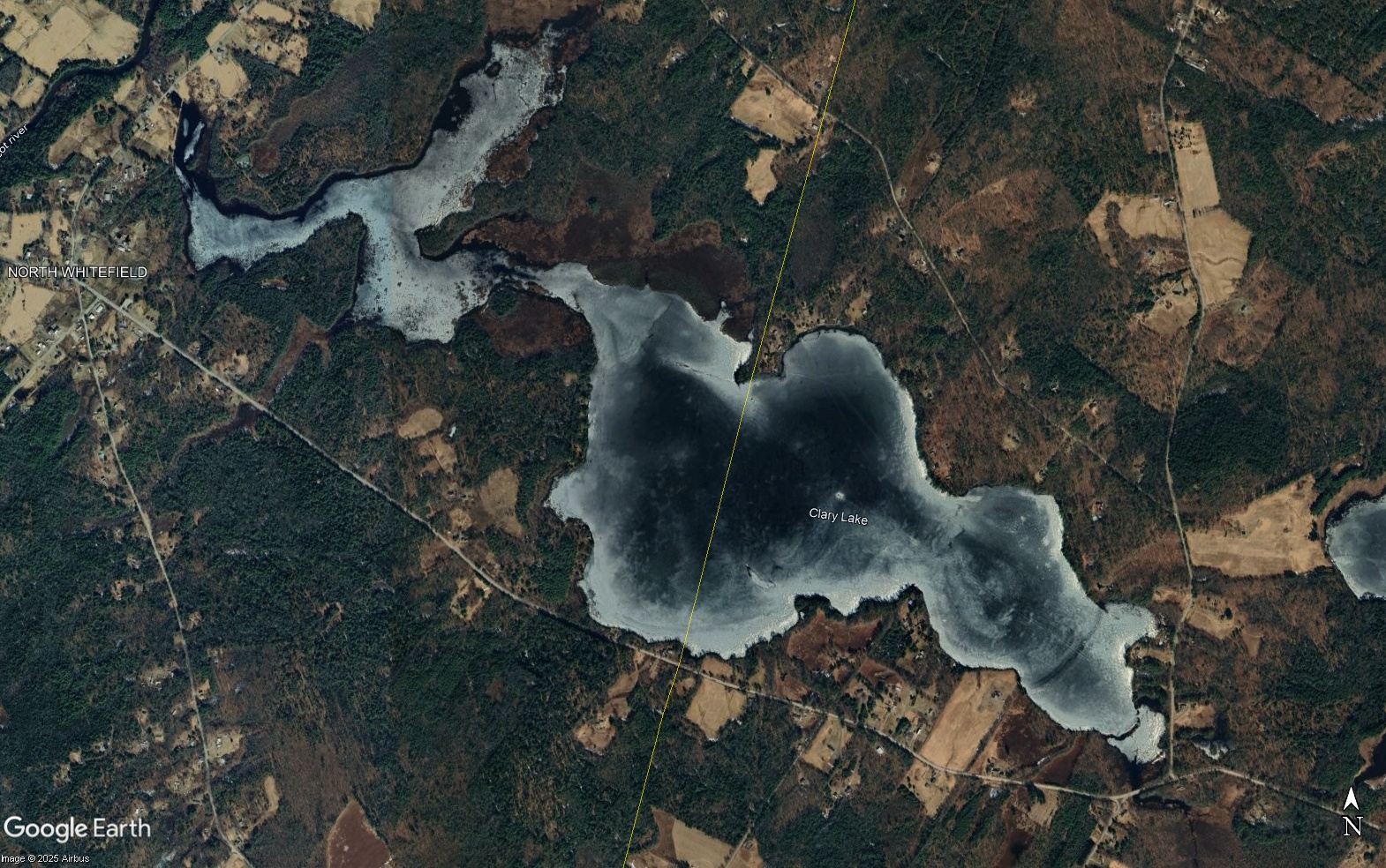
 Google Earth has uploaded new imagery for this area (above and at left) dated March 18th 2025 which if you’ll recall was only 3 days after I closed the 2025 ice out contest. In other words, the current Google Earth view shows an ice-covered Clary Lake with a level of detail that is just astounding. The lake level was actually 0.3′ above the normal HWM on this date or in other words, FULL. This late in the season, there was open water along the shoreline on the north side of the lake (this area get more sunlight than along the south shore). I particularly like the set of wheel tracks that lead in a straight line from the State boat launch to a point just a couple of hundred feet from the lake’s “deep hole” where an ice fishing shack was setup for much of the winter. You can also see a couple of pressure ridges (see Ice Berms & Pressure Ridges) in the traditional places, open water over the shallow sand bar down by the boat launch, and more!
This new imagery is only available on the desktop version of Google Earth Pro, which is free software (go download it!) The browser version and the Android and iPhone apps do not have this new imagery.