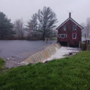
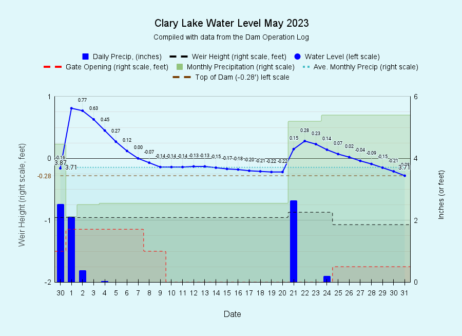
I have archived the March 2023 water level chart (at left). We experienced two large rain events during the month with the result that there was water flowing over the top of the dam for the entire month. The first storm which started on April 30th and ended 3 days later kind of caught us by surprise. It went stationary, ultimately dumping 5 inches of rain on us and raising the lake level to +0.77 above the high water mark, the highest water level we’ve recorded since we purchased the dam back in the fall of 2018. The previous high was +0.58 feet back in April 2020. We thought that was pretty high! At its peak height on May 1st there was over a foot of water flowing over the dam. Then on the 22nd we received 2.65 inches of rain which raised the lake level to +0.28 feet above the high water mark. All told we received 5.40 inches of rain in May, 1.7 inches more than normal. Despite below average precipitation in February and March, for the year we’re 3.79 inches ahead of normal on this date.
 We realize that the extreme high water levels seen in May flooded a few docks (mine included!), broke loose a couple of boats, and resulted in some shoreline erosion in a few places. We regret any inconvenience you may have experienced. This time of year we’re supposed to keep the lake filled “to its maximum capacity” and trying to do that and manage the lake level to accommodate storm water runoff can be a real challenge. The May 1st storm inconvenienced a lot of people around the State including washing out Route 126 about 2/3 of a mile east of the Whitefield Post Office resulting in the road being closed for several weeks. It also broke loose a piece of the floating bog on the
  north side of the lake resulting in a small floating island (picture at left) complete with a dead tamarack, blueberry bushes, wild rhododendron, and sheep laurel happily growing on it. It has become stuck on remains of an old stone wall in about 4 feet of water over by the Prescott camp, near the south shore of the lake and our resident loons have been paying a lot of attention to it, perhaps with the idea of establishing a nest on it. I recall a similar island as a child that floated around Clary back in the 1950s and early 1960s. For a time it hung out over by the Giampetruzzi camp, and I remember climbing around on it with my buddy Robert. It eventually floated off and reattached itself to the floating bog on the north shore from whence it originated. Good times.
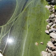
 Another impact of the high runoff into Clary Lake this spring is an earlier than usual algae bloom. By now you know that algae blooms are fed by phosphorus and that the primary source of phosphorus is sediment carried into the lake with stormwater runoff. We had TONS of sediment enter the lake in May and it fed the resident cyanobacteria in the lake. As the bacteria dies off it floats to the surface where winds and current can concentrate it on the shoreline. This was a relatively small scale event that mostly affected people on the south and west sides of Clary. A water sample has been taken to DEP for testing and analysis.
I’m a little late getting the May water level chart posted and way behind in posting pictures in the Spring/Summer 2023 Photo Gallery, but I’ve been a little busy. I’ve got a pile of pictures to upload and hope to get to it over the next couple of weeks. I could use some help! If anyone is interested in helping update and maintain our website, please contact us! No experience necessary!

