[dropcap]I[/dropcap] try to keep this news forum factual and informative and not all that speculative. From time to time however I am compelled to offer up some commentary on what has been happening, where we are and where it looks like we are headed. This is one of those times. My goal is to bring some perspective and commonality into our lives where they intersect with Clary Lake and the travails that have assaulted it for so long. Spring is a good time for this kind of musing: it’s a time to wake up, gear up, get in shape, and get ready for another season. I feel this is going to be an important year, that a lot is going to happen. We may not see a resolution of our water level crisis this year but then again we might, the problem being that I really have no idea what a “resolution” might look like. Certainly we’ll see some real progress towards a resolution. Not only am I prepared to be surprised, I expect to be. If one thing has been proven time and time again it is that we have no idea what lies around the next corner. Continue reading
Category Archives: News
25 March 2017: Update on Pleasant Pond Mill Bankruptcy Filing
I have learned some details of the Pleasant Pond Mill LLC bankruptcy filing. First, it is a Chapter 7 bankruptcy which means the company and its assets will be liquidated by the Bankruptcy Court. Pleasant Pond Mill LLC [PPM] is being represented by a Portland attorney that specializes in bankruptcies. PPM will not emerge from this bankruptcy as a reorganized company; this is the beginning of the end of Pleasant Pond Mill LLC. Rest assured that while this action will wipe out PPM’s debt and dispose of its property, the bankruptcy will have no effect on the Clary Lake Water Level Order [WLO] which is and will remain in force, if not actually enforced, until the pending appeal in Superior Court is finished. Likewise, that litigation will not be affected by this bankruptcy because PPM and Paul Kelley are no longer parties to that appeal. Remember: the WLO runs with the land, not the owner; the new owner of the Clary Lake dam, whomever that is, will be subject to the WLO. Continue reading
21 January 2016: Paul Kelley Introduces himself to the Whitefield Selectboard
Paul Kelley attended the regularly scheduled open (public) meeting of the Whitefield Selectboard on the evening of January 17th to discuss with them issues he has with some Town records, in particular certain Planning Board Meeting minutes. Reference may be had to the following letter which he presented to the Board in open session, which clearly explains his concerns, and what he would like to Town to do about them.
Here is the letter, presented without further comment:
Kelley Letter to Whitefield Selectboard January 17, 2017
It is not clear whether the Town intends to respond to this letter.
05 December 2016: Update on the Recent Police Visit to Clary Lake Dam
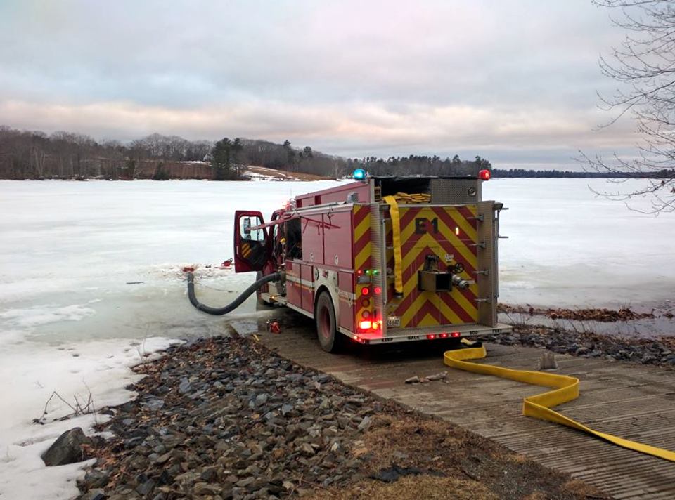
I spoke to a Lieutenant with the Lincoln County Sheriff’s Department today to see if I could find out more about the Lincoln County Deputy’s visit to the Clary Lake dam that I wrote about last Saturday. All the Lieutenant would tell me was there had been a complaint made of “criminal trespass” by Mr. Kelley and that he couldn’t say more at this time due to the ongoing investigation. I thanked him and hung up.
I have collected a little additional information about what was going on that Saturday morning by the dam, from talk around town. Apparently very early Saturday morning while it was still dark, some duck hunters parked two trucks in the field next to the fence near the dam, on property Jane Chase is caretaker of. Presumably they then launched their canoes and headed upstream to hunt. I know there were hunters up in the meadow that morning because I heard gunshots from that direction about 6:30 AM while I was having my first cup of coffee. Several people reported seeing those 2 trucks parked there later in the morning. They were long gone by the time I drove by around 1PM and saw Mr. Kelley talking to the police officer.
Did Mr. Kelley really call the police because some duck hunters parked their trucks on the neighbor’s property and headed upstream to hunt, or was something else going on? We may never know. I doubt we’ll hear much more about what happened Saturday unless there’s something in this week’s Lincoln County News. So move along folks, nothing to see here.
03 December 2016: Clary Lake Dam Gate Fully Opened Today
Today the Clary Lake dam owner was seen opening the dam’s gate (pictured at left) shortly after meeting on-site with a Lincoln County Deputy. I have no idea why Mr. Kelley summoned the police to his property or whether it had anything to do with his decision to open the gate today, but I was told by a passerby that he and the officer were seen standing on the road in front of the dam before he opened the gate and that Mr. Kelley looked “upset” and was “waving his arms” and pointing at the dam. I can’t imagine what Mr. Kelley’s problem might be.
The gate has been effectively closed since mid-summer, and I have been wondering if or when Mr. Kelley was going to open the gate this fall to provide the Minimum Flows required in the Clary Lake Water Level Order
. Flows vary throughout the year: between November 16th and December 31st the Order says the gate should be opened 0.9 feet to provide 15.5 cfs (cubic feet per second) of outflows. Mr. Kelley has in fact opened the gate all the way, approximately 2.5 feet, letting out way more water than the recommended volume. Clearly, Mr. Kelley had more on his mind today than just meeting the minimum flows requirement, and he isn’t particularly interested in garnering anything like goodwill either. It seems to me Mr. Kelley could use a little of that about now.
By early afternoon the water level in the mill pond behind the dam had fallen noticeably. I’ve revised the Water Level Charts to reflect the change in gate status.
Harvest Potluck Supper Flier
These flyers will be going up around town this coming week. Download one!
Harvest Potluck Supper
a benefit for the
Clary Lake Association
Saturday November 12 at Sheepscot General
from 4:00 to 7:00 PM
$7.00 adults, $3.00 children
Mark your calendars! The Clary Lake Association invites you to join us, the community coming together, lakeshore owners, neighbors, friends, and family alike, for a Harvest Potluck Supper to enjoy each other’s company, good home cookin’ and to celebrate our Lake.
We are still looking for volunteers willing to contribute food: crockpot items, casseroles, salads, desserts, & beverages. People interested in contributing to this event, please contact Margaret Fergusson @ 207-458-3143, Mary Gingrow-Shaw @ 207-622-3308, or Erin Grimshaw @ 207-346-4640.
Hope to see you there! Check for updates on the Clary Lake Association website as the event draws near: https://clarylake.org/
07 October 2016: Remote Access to All 3 ClaryCams Finally Working
Real-time remote access to all 3 Clary webcams is finally working. My tendency is to explain in excruciating detail WHY it wasn’t working and WHAT I had to do to get it working. Instead I’ll just say there was a port conflict and a few other issues which prevented operating 2 cameras on the same internal network at the same time, and leave it at that.
Remote access to firewalled equipment requires Dynamic DNS service, and that is notoriously flakey. When access to a camera is NOT working, it is almost always due to the DDNS being out of date. DDNS is a mechanism whereby a dynamic IP address (which most of us have) is mapped to a static host name (which most of us want). Foscam, the camera manufacturer, runs a free DDNS service for their customers but it seems like it often doesn’t update the static host name with the right IP address in a timely manner. I’ve setup an account with a 3rd party DDNS server for my two cameras (Clarycam1 and Clarycam2) which seems to be working well. If it continues to work well I’ll see if I can get David Hodsdon to signup with the same service. For now his camera which is using the Myfoscam.org DDNS service is working fine…
Bottom line: If you try to connect to a camera and it fails, try again in half an hour. Continue reading
06 October 2016: Clary Lake Parcel Map Now Online
If you haven’t figured it out by now, I love maps. I love looking at maps and during my nearly 4 decades in the Surveying profession I made a lot of maps, as part of my job. Now I make maps for fun and making cool and useful maps has gotten faster & easier with freely available Geographic Information System and CAD software integrated with database systems and online mapping services like Google Earth, Google Maps, and Google Fusion Tables. Enhancing traditional data with Geocodes (latitude and longitude) like a mailing list allows you to look at information in ways that hasn’t been all that easy to do in the past. This latest map is a Parcel Map (image above) that I’ve just completed using Google Maps and Google Fusion tables which shows property parcels in and around the Clary Lake Watershed with blue dots representing the locations of everyone in our Clary Lake mailing list database. It wasn’t particularly hard to do, the tedious part was scaling a latitude and longitude off a map and assigning it to a name in a spreadsheet. The rest was just data manipulation. The tax parcel information comes from the Maine Office of GIS, a great site which offers loads of free geocoded data, digital terrain data, and photography.
Some of you will recognize this map as similar to the Clary Lake Watershed Survey from a couple of years ago which uses the same parcel information, and the Clary Lake depth map which uses the same base map of the area. Continue reading
Test Posting Complete with Picture [UPDATE]
[UPDATE]: After pondering the problem I wrote about last night while I slept, I got up this morning and killed/reestablished the backend connection to WordPress.com and lo and behold, both notification emails and automagic posting to Facebook is working again.
It’s not a job, it’s an adventure.
I’ll be posting a few test articles in an attempt to resolve the email notification problem. Your patience is appreciated.
CLA Harvest Pot Luck Supper This November 12th
Mark your calendars! The Clary Lake Association Momentum Committee invites you to join us- the community coming together, lakeshore owners, neighbors, friends, and family alike, for a Harvest Potluck Supper to enjoy each other’s company, good home cookin’ and to celebrate our Lake.
Our Potluck supper will take place on Saturday, November 12, 2016 at The Sheepscot General on Townhouse Road in Whitefield from 4-7pm. The full scope of the event is still being developed, but we are now actively soliciting volunteers willing to contribute food— crock pot items, casseroles, salads, desserts, beverages. The cost is $7.00 for adults and $3.00 for children under 12. There will also be a raffle with details to be announced. Also look for ongoing updates here about the event as the date draws closer. You’ll find this event marked on the CLA Events Calendar. The Harvest Supper is coming up [fergcorp_cdt_single date=”November 12, 2016 3:00 PM EST”].
Add this event to your Google Calendar: ![]()
The Momentum Committee was formed to foster a positive outlook as we move forward, appreciating what we have been given even in the face of the challenges presented by our lake’s current condition, acknowledging the challenges ahead, remembering all the hard work that has been done and will need to continue to be done in order to bring our lake back to its full health. It’s a call to thankfulness, generosity and goodwill and to focus on the simple yet powerful potential in people coming together. This event will be one of many in our continued commitment to celebrate the bounty of community and the importance of reverent stewardship of our nature resources.
The money raised will be used in part to fund future Momentum Committee events and activities. For more information or to contribute to this event, please contact Margaret Fergusson @ 207-458-3143; Mary Gingrow-Shaw @ 207-622-3308, or Erin Grimshaw @
207-346-4640. You can also email the Momentum Committee with questions or suggestions.
18 September 2016: NIDIS Drought Meter Now Online
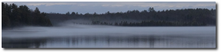
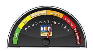
I don’t need to tell anybody that we need rain. For some time now we’ve been experiencing SEVERE drought conditions around Clary Lake and SEVERE to EXTREME drought conditions in and around New England, depending on locale. I found this neat CGI script at the National Integrated Drought Information System site that provides up-to-date drought information and decided to put it on our website. Enter one of Clary Lake’s 2 Zip Codes (Whitefield o4353 or Jefferson 04348) for current drought conditions here. For current drought conditions in your area, enter your own zip code (or search for one). You can reset it with the reset button to check different areas. It works for the entire country.
Once you’ve entered a zip code, you’ll find some useful information by following the links provided under the Drought Meter graphic. The National Integrated Drought Information System is a great site to poke around. I’ve added it to our Links & Resources page.
I have put up a Drought Meter page. Check it out. You’ll find the page linked under the Weather Main Menu heading.
In Memory of Christopher Gillette
It is with sadness that I inform you of the passing of Christopher Gillette this past August 12th. Chris was a long-time and loyal Clary Lake Association Member and a personal friend of mine with whom I have corresponded at length in recent years about Clary Lake. He will be missed by many. The Board, and on behalf of the Clary Lake Association, wishes to offer our condolences to his wife Leslie Gillette, his 2 daughters Fallon and Alexandra, his father Thomas Gillette, his brother Baxter Gillette, and his cousin, Kate Seba, all of whom are Clary Lake Association members. Chris had just completed the construction of a new home on Clary Lake. Chris was 61.
08 September 2016: DEP Administrative Record Now Available Online
On August 17th DEP filed their Administrative Record with the Lincoln County Superior Court in preparation for moving forward with their defense of the Clary Lake Water Level Order. I wrote about this back on September 1st (see: DEP files Administrative Record with Superior Court). The State’s filing consisted of a 20 page document that listed the descriptions of 264 items totalling 345 megabytes of material, which are all included on a CD. I was particularly interested in getting a copy of the CD partly because it seemed like every other document had my name associated with it, and partly because there were a goodly number of documents listed that I do NOT already have in my files, primarily internal Department and Interagency communications, and correspondence between DEP staff and Paul Kelley that was not shared with the Service List. Continue reading
28 August 2016: State Boat Launch Rock Cleanup Initiative Finished
We had a great turn out for the Boat Launch Rock Cleanup event yesterday with 30 people showing up to move rocks or assist in other ways. A few people unable to move rocks fulfilled other important roles. Everyone contributed in one way or another. The rock moving itself, which was expected to take the better part of 4 hours, was pretty much finished before lunch, in about an hour and a half.
The folks in the group-photo are left to right, front row kneeling: Lucy Norman, Erin Grimshaw and her 3 sons Corey Dey Bishop, Jayden Dey Bishop, and Devon Dey Bishop, Colin Fergusson; Second row: Don Norman, Melissa Palmer-Karas, Alicia Fraser, Mary Gingrow-Shaw, Margaret Fergusson, George Fergusson (not smiling for some reason) Karen Nielsen and Sara Roy; Third row: Dee Ann Grazioso, Barbara Ahern, Bill Donovan, Osmand Karas, Nathan Williams, John Williams, Tom Vigue, Jeff French; Fourth row: Tim Harkins, David Knight, Jack Holland, Randy Wing. Not pictured are Ellis Percy and John Ahern who weren’t involved in the rock moving, and Thomas Gillette and Bruce MacDonald who showed up later when the work was finished.
The work got done, we had a blast, nobody got hurt, and nobody freaked out when a good sized water snake crawled out of the shrinking rock pile and swam off between people’s legs. I caught a brief glimpse of it but wasn’t quick enough with my camera to get a picture of it. Continue reading
Clary Lake Association To Clear Rocks at State Boat Launch Saturday August 27th
The Clary Lake Association has received authorization from the Maine Department of Inland Fisheries & Wildlife (IF&W) to clear some rocks away from the end of the State boat launch. These rocks constitute a boating hazard which over the years since the boat launch was built have claimed more than a few outboard props and lower units. After discussing this project with representatives of the IF&W, the Clary Lake Association requested IF&W file for a Permit By Rule with the Maine Department of Environmental Protection under the National Resource Protection Act’s Permit By Rule Standards. They did just that, and we received the go-ahead to do the work earlier this week.
The applicable rule is Chapter 305 Section 6 “Movement of Rocks & Vegetation” which provides for limited clearing of rocks and vegetation by hand from a 10′ wide area. Other requirements of the work to be done are that the rocks cannot be removed from the lake gut must be redistributed into small piles that fish fry can use to take refuge, rather than just randomly scattering them. Since this exercise is to remove a boating hazard, the rocks obviously shouldn’t be piled up in a fashion or location that will have them interfering with boat traffic in the future.
Obviously, this work needs to be done while the water level is low. Once the fall rains start and the lake level starts to rise, it will be too late. The water level is currently a little over 65″ below the top of the dam, about 2″ lower than in the photograph above which was taken last summer in July. To that end we have tentatively scheduled a work session (I prefer to call it a party) from 10:00 AM to 2:00 PM on Saturday August 27th to do the rock clearing and we’ll be looking for volunteers to help with the project. Many hands will make the work go quickly! In the next day or so we’re going to send an email mailing to Clary Lake Association members to drum up interest in helping with this project. There are a number of ways you can help with this project. If you’re interested in participating in the actual rock moving or just want to come by, enjoy the event, have fun, and support us in this endeavor, please contact George Fergusson or give me a call at 207-549-5991.
Since we’re going to be splashing around in 6″ to 12″ of water, we’ll be doing this work rain or shine unless there’s an absolute deluge that day in which case we’ll put the work off until the next day. People interested in helping should wear rubber boots or sneakers because you’ll be getting wet. We also recommend gloves. We’ll have a few crowbars available for those recalcitrant stuck-in-the-mud rocks.
There’ll be a cookout around lunch time, and contributions toward this are welcome. It promises to be a fun event. We look forward to your participation!
24 July 2016 Centralmaine.com: Repair work begins on Branch Pond Dam

Picture of the Branch Pond dam and mill showing the upstream face of the dam. This picture was part of the Branch Pond Association’s 2008 Water Level Petition.
According to an article in today’s Kennebec Journal and Morning Sentinel by staff writer Madeline St. Amour, repairs have finally begun on the Branch Pond dam. Branch Pond and it’s dam are located in China and Palermo at the headwaters of the West Branch of the Sheepscot River and are subject to a water level order issued by the Maine Department of Environmental Protection in June 2014. The WLO was issued in response to a petition filed by the Branch Pond Association originally back in 2008. The petition was put on hold for 4 years to give the dam owners time to make repairs to the dam. No work was performed in that time however, and the petition process was restarted in 2012 about the same time as the Clary Lake water level petition was getting underway. I have remained in close contact with members of the Branch Pond Association over the past 4 years and I am pleased that DEP is now taking aggressive steps to enforce their Water Level Order, and happy for the Branch Pond lake shore owners who are finally seeing their efforts rewarded. Congratulations Branch Pond Association! Here’s the article:
- Repair work begins on 200-year-old China dam after state agencies, owners sign agreement
- Archived Local Copy (without images)
I received a few phone calls this morning from Clary Lake shore owners who saw the article in this morning’s paper and wanted to know why DEP isn’t enforcing our Water Level Order with the same enthusiasm. This reaction is totally understandable. While there are many similarities between Branch Pond and Clary Lake, there are 2 very important differences. Continue reading
18 July 2016: Alarming Growth of Elodea Observed in Clary Lake

Elodea nuttallii in Clary Lake growing to the surface in 7′ of water. Photograph by George Fergusson 15 July 2016
Just when you thought conditions around Clary Lake couldn’t get any worse, well conditions got worse: anyone who has spent any time on Clary Lake this summer is all too aware of the explosive growth of Elodea in shallow areas around the lake. Rapid growth of this pond weed was a noticeable problem last summer and it has only gotten worse, not better. Elodea nuttallii is not a recognized invasive plant species in Maine but it is considered invasive in some jurisdictions including in Europe where it is a real problem. It’s an opportunistic plan in any case, and under the right conditions it can be very prolific. Clearly the conditions existing in Clary Lake now are about perfect to promote exuberant growth of this plant: lots of shallow water with a muddy bottom, plenty of nutrients, and lots of sun. Elodea growth has gotten so bad in some places that there are large mats of the weed on or just under the surface of the water, even near the middle of the lake. I took the above picture about 1400′ off the south shore of the lake- almost 1/3 of the way across to the other side- in 7′ of water. Normally the water would be 12 feet deep here, too deep to support the growth of Elodea. Now, with the lake level down 5 feet below the top of the dam, conditions are perfect. Everywhere you go it seems you’re seeing Elodea at or just below the surface. You’ll find more pictures in the Spring/Summer 2016 photo gallery. Continue reading
07 July 2016 Loon Update: Nest OK, Still No Chicks
2016 Fourth of July fireworks. It appears the fireworks displays around the lake on Monday night did not disturb the nesting loons which were observed calmly nest-sitting the next day. Photograph by George Fergusson.
[dropcap]Like[/dropcap] a nervous parent, I have been checking the loon nest every day lately, and sometimes twice when I get the chance. This morning I observed one of the loons sitting on the nest but there is no evidence yet that the eggs have hatched. As near as we can tell the nest was established sometime around the 6th or 7th of June- at least that is when Randy and Arlene Wing first noticed the pair of loons hanging out around the nest site. Exactly when the nest was completed and the eggs laid is not clear but they were seen sitting on the nest by June 11th. That was 27 days ago. With a gestation period between 26 and 30 days, the eggs could hatch anytime. Continue reading
05 July 2016: Pictures from the 46th Annual Maine Lakes Conference
Some pictures from the Maine Lakes Society’s 46th Annual Maine Lakes Conference held back on June 26th. My wife and I attended the meeting and it was quite good:
22 June 2016: Loon Nest Update, New Pictures Added to Site
[dropcap]The[/dropcap] nesting Loons are doing fine and it appears that people are respecting the bird’s need for privacy and not venturing inside the LOON AREA signs. I stopped by today to try out my hastily-fabricated telephoto lens arrangement and took some pictures of the loons that came out rather well I think. Though it looks like I was right on top of them, I wasn’t. Not even close. From where I was set up on the lawn looking down on the nest, my range finder said I was about 390′ away from the nest. The loons barely took notice of me. The pictures were taken with a 6″ f/5 Newtonian reflector telescope which I normally use for observing stars, planets, comets, and nebulae. I hooked my digital Nikon D3300 camera up to it which gave me what amounted to a 762 mm focal length telephoto lens. By adding a 2x barlow lens I was able to double that to effectively a 1524 mm focal length telephoto lens. Continue reading


