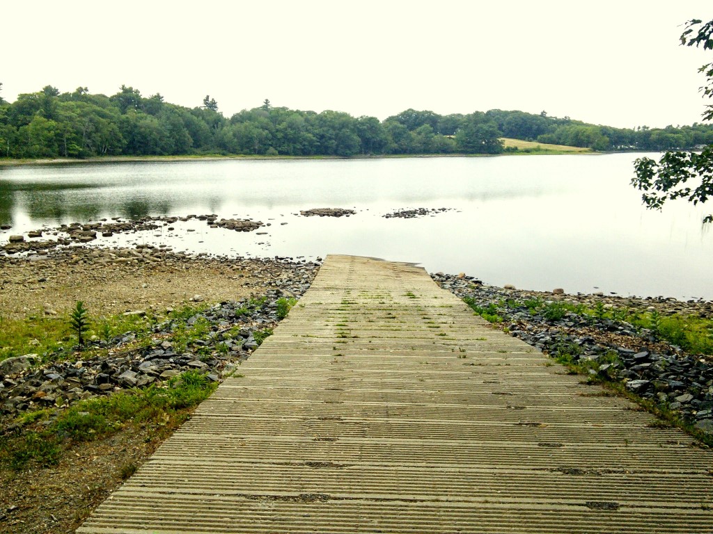
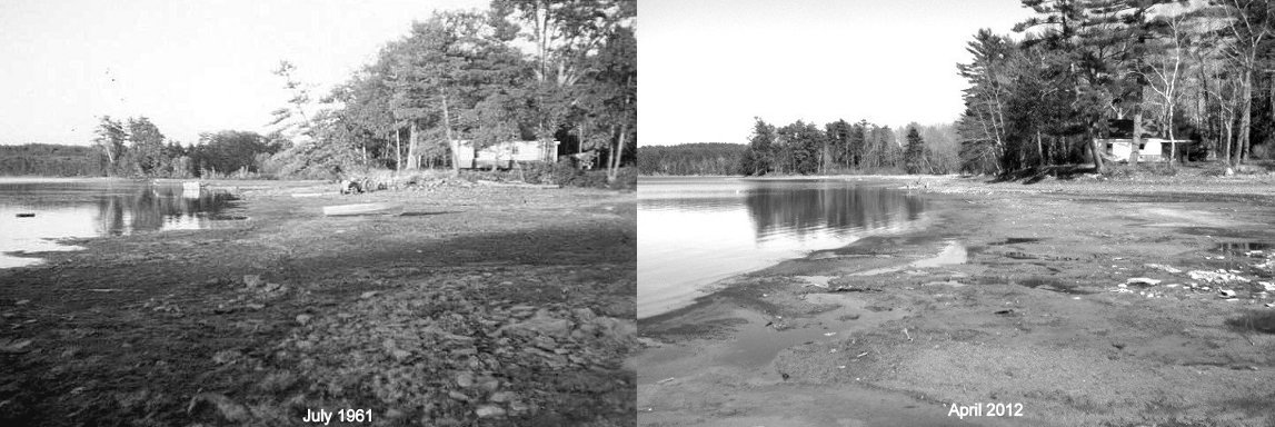
 I don’t need to tell anyone that the lake level is low, that much is obvious. However the lake is now lower than anyone has seen it in more than 54 years judging from a picture taken back in the summer of 1961, and that seems like something worth telling people about. On April 21, 2012 the lake fell to a then-record low of -62.53″ but as of the other day, the lake level had fallen even lower than that, to -62.64″ below the top of the dam, where it sits now. I went over to the State boat launch with my camera to take yet another picture of how useless it is and found the water level had fallen off the end of the ramp. Continue reading
Category Archives: Lake Environment
10 July 2015: Declining water quality, by the numbers [UPDATED]

I’ve noticed over the past 4-5 days the lake color has gotten decidedly murky and brownish/green but I was still surprised the secchi disk reading so low. I probably shouldn’t have been given how dry it’s been and how low the lake is as these factors contribute to conditions conducive to the growth of filimentous cyanobacteria (aka blue green algae) which are responsible for algae blooms. Once the conditions are right for cyanobacteria to start multiplying, their growth can be explosive.
We’ll take a water sample for phosphorus testing during our next water quality monitoring session in 2 weeks. Phosphorus tests cost $25 a pop to get them analyzed by the State so we usually only do 3 tests per year.
[UPDATE: 7/14/2015] Based on the latest secchi disk reading taken about 1/2 hour ago, Clary Lake is officially having an algae bloom. The reading was 1.95 meters (6.40′). As mentioned above, a reading at or below 2 meters is considered to be an algae bloom.
08 July 2015: Lake shore owners concerned about invasive aquatic plants [UPDATED]
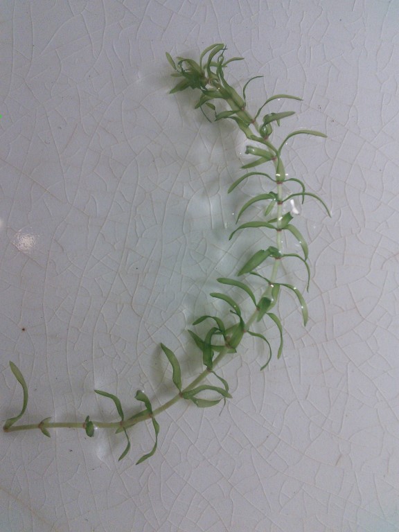 Last week I noticed some large and extensive mats of a green pond weed over by my shoreline in about 2′-3′ of water, thick enough to foul my trolling motor and bring my boat to a halt. I collected a sample and identified it as Elodea or American water weed (or Common Pond Weed). I was therefore not particularly surprised when Thomas Gillette showed up at my house yesterday with a shopping bag full of this plant, concerned that Clary Lake might have an invasive plant infestation underway. Thomas told me that Butch Duncan had brought it to him, saying that there were thick mats of it over in the cove on the north side of the lake by Duncan Road.
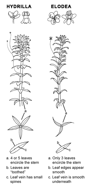 I reassured Thomas that this was not an invasive species. We’ve had this plant growing in Clary Lake forever but it’s always remained under control. You’d see a few pieces of it wash ashore from time to time or you might see patches of it up in the channel. Recently however, conditions around the lake have become quite conducive to this plant’s rapid growth in areas where it was not found before. Elodea is not a recognized invasive plant species but under the right conditions it can and does become a nuisance, clogging shallow water areas with thick mats of vegetation. Elodea likes nutrient-rich water down to several meters (5′-7′) in depth, plenty of sunlight, water temperatures between 10° C and 25° C and a soft, silty or muddy bottom where it’s thin wiry roots can get a good foot hold. You won’t find Elodea on a rocky or gravel bottom. With the water level down 5′ and 50% of the volume of the lake gone, conditions around Clary Lake are near perfect for this plant’s growth to explode: the reduced lake volume increases the concentration of nutrients in the water and the lowered lake level allows sunlight to reach down to silty/muddy areas that would normally be under 7′ to 10′ of water where Elodea wouldn’t normally be found, or be able to survive. Now our shallow water areas are a perfect habitat for Elodea.
June 2015 Water Level Chart archived
 I’ve archived the June 2015 water level chart. The lake level remained in a fairly tight range for the whole month, fluctuating only ± 3.7″ and ending up the month a little off its lows at -57.36″ below the top of the dam. It fell to 62″ below the top of the dam on June 20th, only the second time in 4 years it has gotten that low. In comparison, during the month of May the lake level fell precipitously at over 1″ per day, for the entire month. Despite the above average amount of rain we received in June (5.46″ compared to an average of 0nly 3.54″) the lake level remained largely unaffected because so much of the precipitation soaked into the ground rather than running off into the lake. As a result, the runoff multiplier was closer to 1X to 1.5X rather than the normal 4X multiplier. May’s rainfall total was so far below average (only 0.60″ compared to an average of 3.7″) that even with all the rain we received in June, we’re still several inches below normal.
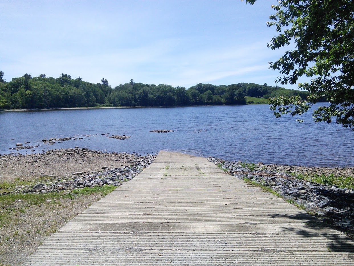
The state boat launch remains largely unusable except for carry-in traffic and small boats if you’re able to manhandle them on and off their trailers and are willing to drag them across the rocks and shallows to get to and from deeper water; not many people are. I’ve seen a number of vehicles pull into the launch area with boats on trailers only to leave after seeing exposed rocks off the end of the ramp. Can’t blame them. As a result, boat traffic on Clary Lake this summer is noticeably below normal. Anyone who does manage to get their boat launched has to contend with shallow water and rocks where you least expect them. Only a few of the hazards are marked, leaving vast areas too shallow for safe boating to surprise the unfamiliar boater.
There is ample evidence around the lake of the impact of the ongoing severely low lake levels besides an unusable boat launch, and rocks sticking out of the water. As a result of fluctuating water levels, the loons that call Clary Lake home have not even bothered to try nesting this year, or last. Their last successful nesting attempt was back in 2008. Even more damaging to the ecosystem is the loss of 350+ acres of sensitive, high-value wetlands and the shallow-water littoral zone around the edge of the lake so important for lake health and for bird, fish, and animal habitat. Gone.
28 May 2015: A Black Crappie caught in Clary Lake
Jack Holland sent me a picture the other day of a full-grown Black Crappie that was caught by 9 year old Eric Richmond in Clary Lake last week. According to his mother Rachael Richmond, they were fishing near the State boat launch and caught the 2 fish in the photo at the same time (the other one is a white perch held by Eric’s sister). They let both fish go.
Jack tells me that he believes his neighbor has caught 2 crappies in the past couple of years so it sounds like there’s a new species of fish in Clary Lake. The Black Crappie aka Calico Bass (Pomoxis nigromaculatus) is a non-native species in Clary Lake meaning it was introduced either intentionally by someone who wanted to supplement the lake fishery or accidentally by an ice fisherman by releasing bait. Both actions are in violation of State law. From the Maine IF&W website:
Adult Size: Sexual maturity is reached between 2 and 4 years of age, at which time crappies may be 6 to 10 inches long. Typical crappie fisheries produce fish between 6 and 11 inches long, although crappies exceeding 14 inches and 3 pounds have been caught in Maine. I think it’s safe to assume there is a breeding population in Clary Lake now.

Black Crappie. Click on the image to go to the IF&W site
Identification: Closely resembling bass and sunfish species, which have 10-12 dorsal fin spines, crappies possess 6-8 dorsal fin spines. Body form is very deep and narrow (laterally compressed). Coloration is silvery-olive to golden brown, with an irregular mosaic of dark black blotches.
Crappies are a popular fish with a lot of people and are supposedly quite good eating. If you catch a crappie in Clary Lake, please let us know. Biologists with the IF&W would like to know too.
A strange visitor…
A strange visitor
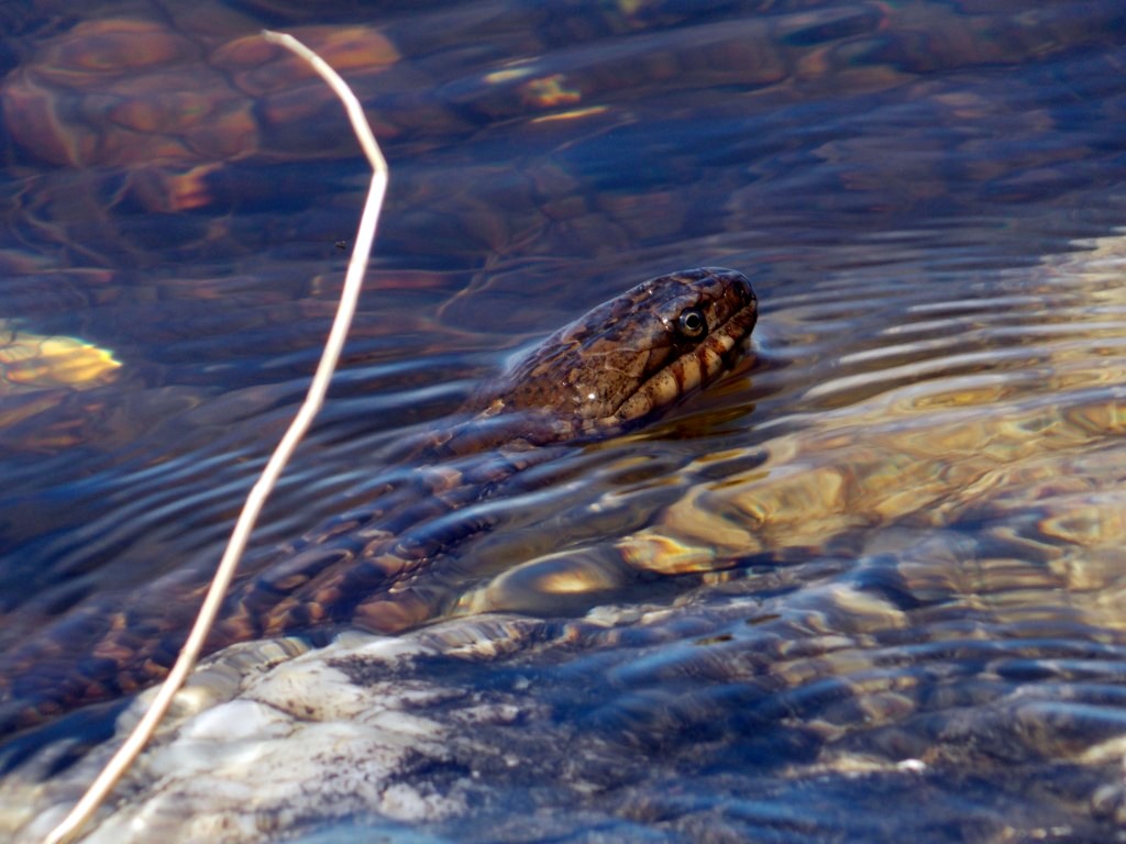
The other day my neighbor Steven Giampetruzzi uploaded a couple of pictures to the website documenting his recent close encounter with a rather large specimen of northern water snake (Nerodia sipedon). From the picture it looks to be at least 3′ long and quite healthy looking, don’t you think?
I know some people are freaked out by snakes, but you shouldn’t let water snakes bother you because they’re harmless, non-venemous, and they eat leeches among other things. I’d always been told there were water snakes in Clary Lake, but it wasn’t until a couple of years ago that I actually saw one for the the first time. One afternoon I was sitting on my dock relaxing when I spotted what I thought was turtle swimming slowly 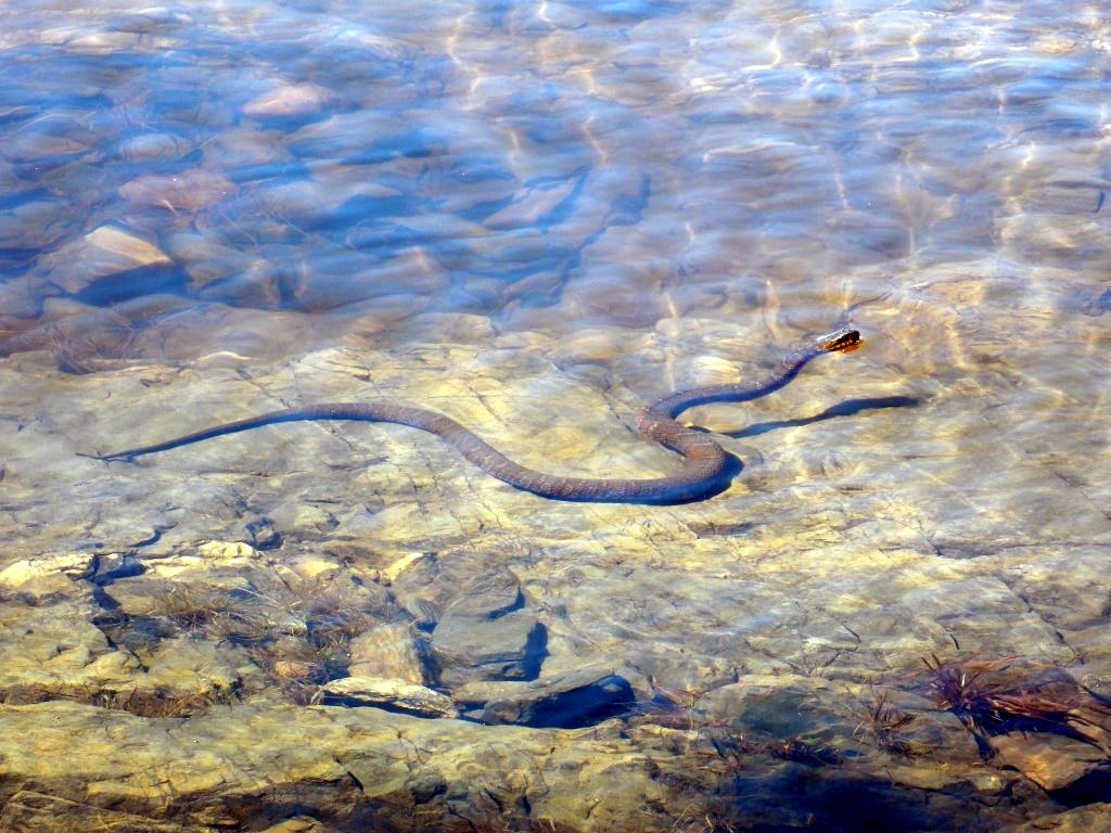 toward me. As it got closer I could see it was a snake’s head, sticking out of the water like a submarine’s periscope. It got to within about a yard of the dock where I was sitting when it spotted me, and submerged. It was almost as big as the one in this picture. It turned out it was living under my dock and I I continued to see it and a smaller snake in the area off and on for the rest of the summer.
In any case, thanks Steve for uploading those awesome pictures! And a reminder to the rest of you, feel free to upload your own pictures to the site using the Picture Upload Page or just email them to me and I’ll post them.
02 May 2015: Clary Lake water quality monitoring resumes
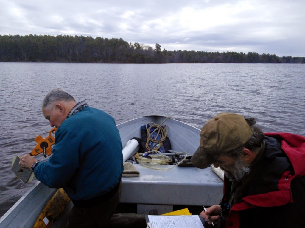 Water quality monitoring for 2015 resumed on April 30th. David Hodsdon and I tried to get out the previous week but the wind was so strong my anchor was dragging and we couldn’t stay in one place. This date is about average for the first data collection exercise of the year. We’ll try to get out every 2 weeks throughout the boating season. This also marks David Hodsdon’s 40th consecutive year of water quality monitoring for the VLMP. Quite a record!
The water was quite clear with a secchi disk reading of just over 11 feet. You can view current data and that for recent years on our Clary Lake Water Monitoring Data page (we also have data back to 1975 when David Hodsdon started his water quality monitoring efforts, available upon request). Our collection station is over the “deep hole” which we locate with a GPS and the data we normally collect includes air temperature and wind speed, water depth, clarity (secchi disk reading), and dissolved oxygen and temperature measurements at the surface and at 1 meter increments all the way to the bottom of the lake. Approximately 3 times per year we take a core water sample for phosphorus which we send off to the State for analysis. We took one this time.
You can read more about the VLMP and our water monitoring efforts on the Volunteer Lake Monitoring Program page.
Time Lapse Video of Clary Lake Ice Out, Spring 2015 [UPDATED]
Over the last 4-5 days there has been a LOT of traffic to the web cam page, people have apparently been anxiously following the progress of the ice going out. I sure have been. Here is a time lapse video showing the ice going out over the last 3 days, compressed into 92 seconds:
The video is comprised of the same photographs you see on the web cam page which are posted to the site every 2 minutes. I’ve removed the night time shots to keep the file size small. Most of the ice-out action happens on the 3rd day (April 18th). If you’re paying attention you’ll spot a muskrat swimming back and forth a few times and a few birds popping in and out of the scene.
Nobody is more surprised at how fast the ice went out this year than I am. On April 9th the lake was solidly frozen over with 6″ of new snow on it. Today, 9 days later… and there is just a little ice left hanging onto the edges in a few place. The ice isn’t officially out until David Hodsdon says it’s officially out. I’ll post the official date on the Ice-In and Ice-Out Dates page when David gives it to me.
 [UPDATE: 19 April 2015] Well the southeast end of Clary Lake still had a lot of ice floating around this morning, but David Hodsdon tells me this afternoon that it all disappeared mid-morning today. So the official ice-out date this year is today, April 19th. It’s about average.
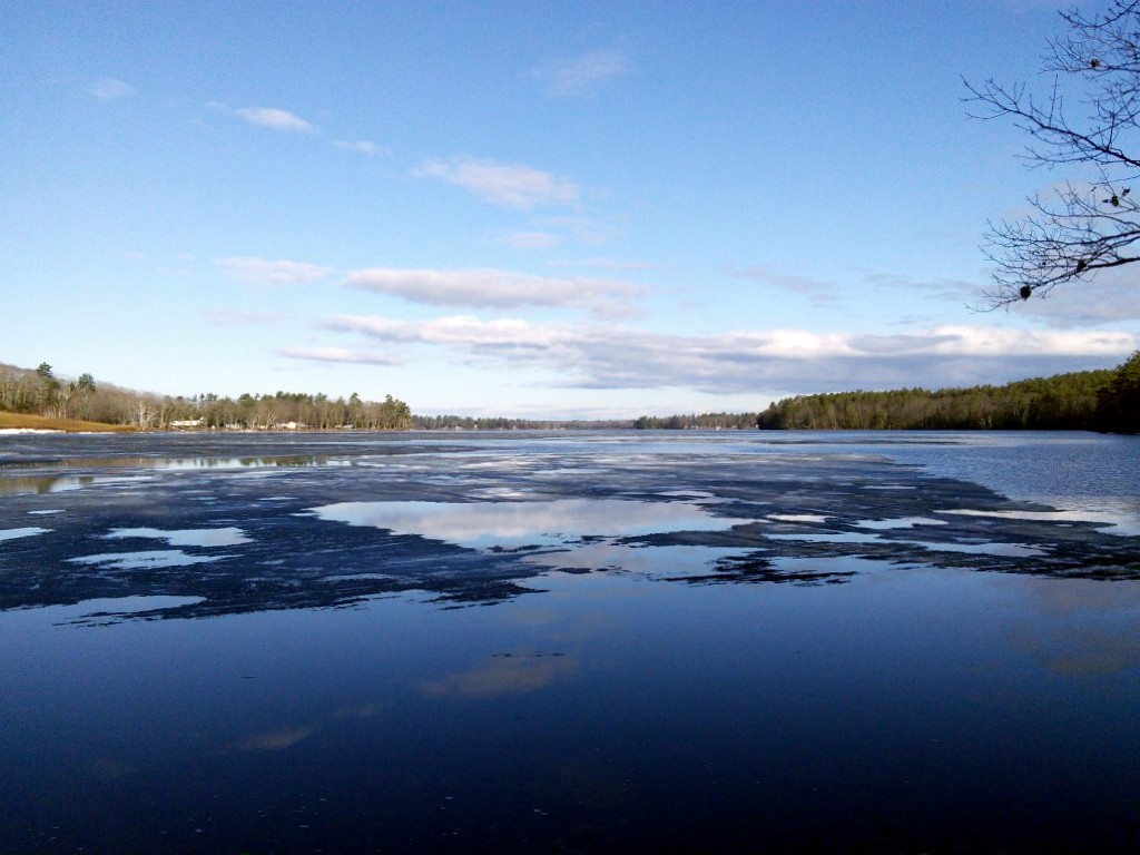
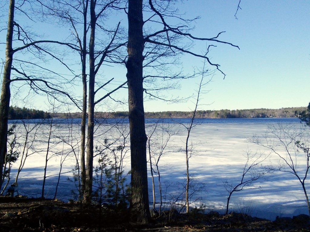
16 April 2015: What a difference a few days make
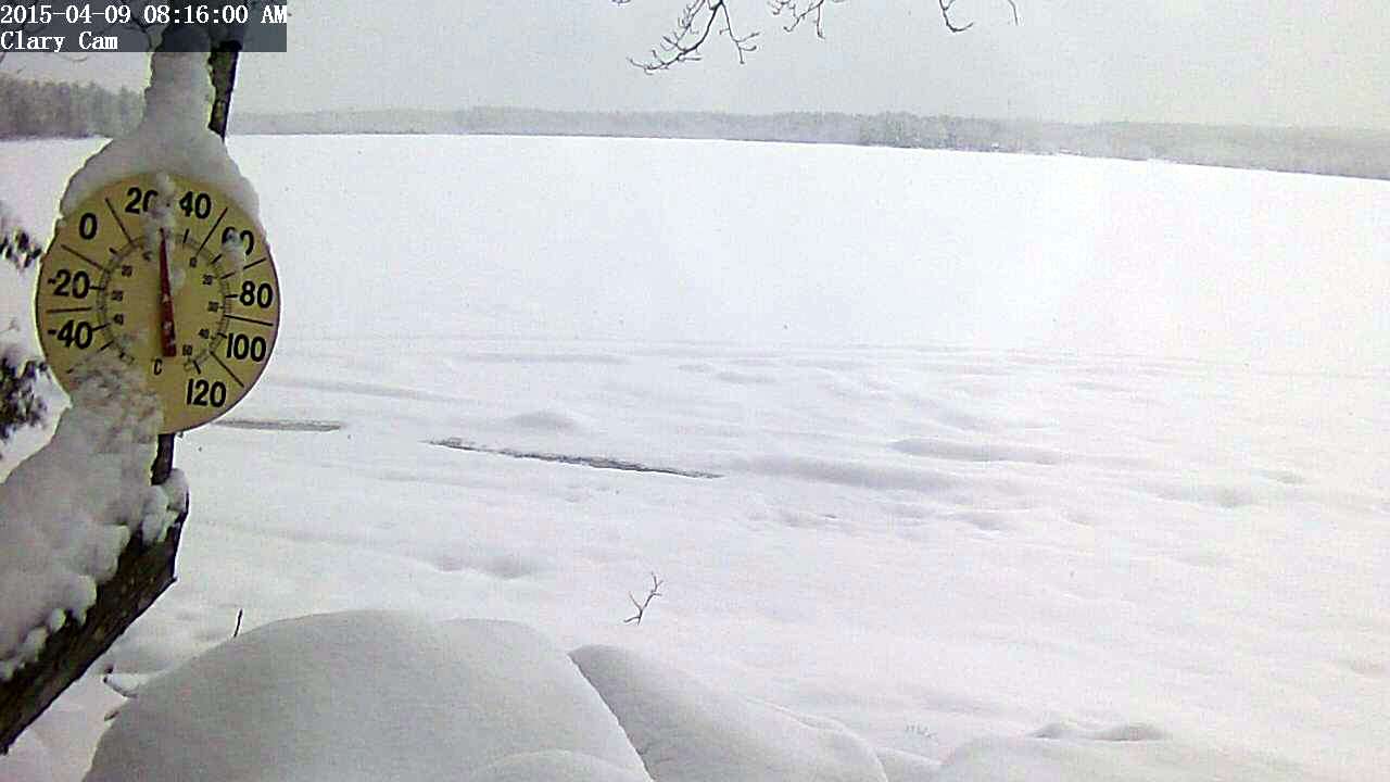
This was April 9th, lake fully covered with ice and 6″ of new snow:
This was yesterday, 9 days later, snow all gone and half the lake open:
09 April 2015: 6″ of new snow better than sharp stick in eye
“Waking up to 6″ of new snow today was a little better than a sharp stick in the eye” George Fergusson announced at the Whitefield Superette this morning. “but the expression on my wife’s face when she looked out the window was truly pitiable.” George’s recommendation is to get out and make one final snow man before tomorrow’s rain and this coming weekend’s 50° plus temperatures turn today’s winter wonderland into tomorrow’s quagmire of mud. “Before you know it you’ll be doing yard work with a cloud of black flies around your head. This is just a temporary setback.”
01 March 2015: A clear and cold start to the month
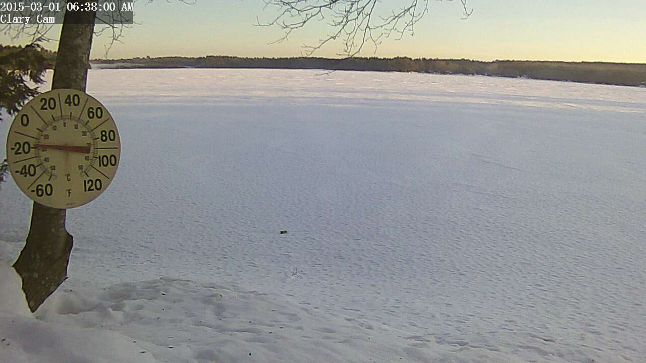 It was a clear and cold -15° F this morning when I got up, pretty chilly for the 1st day of March. As cold as it has been this winter, it appears the channel has remained open. You can see in the web cam image from this morning that there is some fog up in the northwest end of the lake where the channel starts. This indicates open water. I’ve seen this phenomena off and on this winter when conditions were right. Sure hope the weather starts warming up soon.
I had hoped to resume water level measurements today but the weather is going to have to moderate a lot and a whole load of snow is going to have to melt before I venture down to the lake. There’s easily 6′ of snow on my shoreline and I have no inclination to try floundering through that to find the ice, and then have to chop a hole in it, find my bench mark, yada yada. I will make a point of swinging by the dam today and guestimate the water level at the railroad abutment, that should give us an idea within a few inches of what the lake level is.
02 January 2015: Extraordinary skating on Clary Lake, and a word of caution
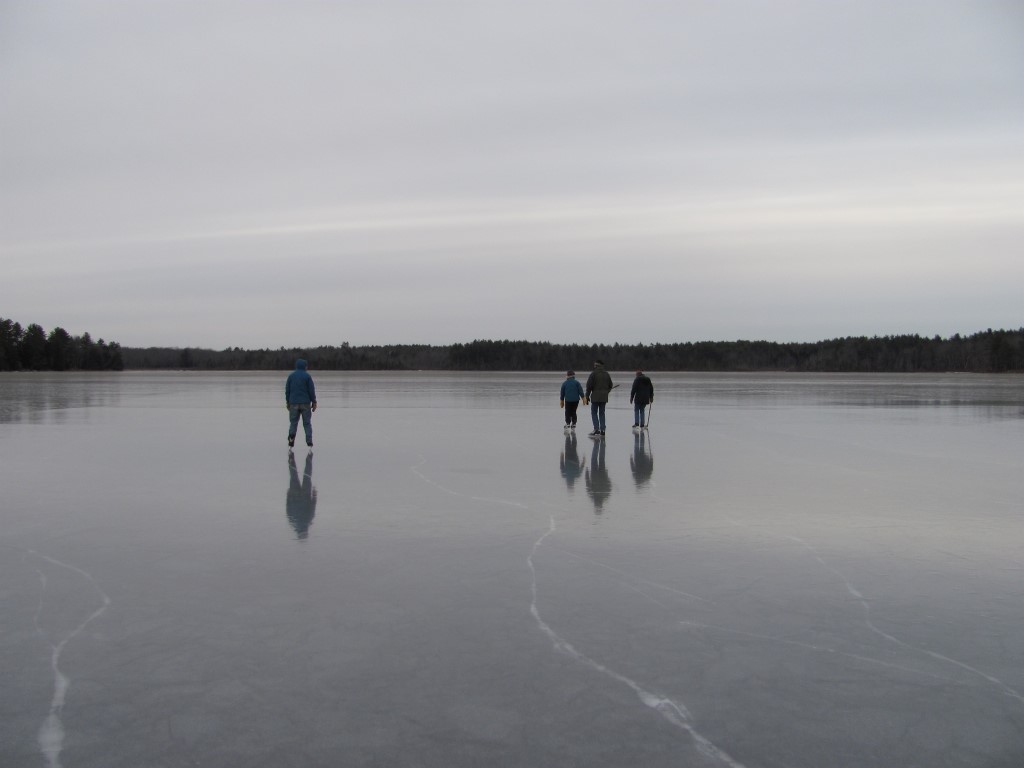 The ice skating on Clary Lake has been extraordinary this year, and a good many people have taken advantage of the fabulous conditions. This afternoon I was out skating and encountered 4 people from Waldoboro (at left) who’d heard about the excellent skating conditions on Clary and came by to see for themselves. They were suitably impressed. Unfortunately the snow, sleet, and freezing rain storm coming in tonight will likely put an end to skating this winter. Here’s a video I shot this afternoon.
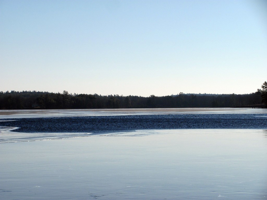 A word of caution: despite the low temperatures, there is still a considerable amount of open water out in the middle of the lake, (see video above) and a few open or mostly open leads around the shore where you wouldn’t expect to see them. This condition is due to a combination of the relatively high water level (2′ below the top of the dam) and a strong current resulting from the dam’s gate being wide open (the lake level is dropping about 1″ per day now). The current flows in a generally straight line from the inlet by the State boat launch passing close by the point at the end of the Duncan Road, to the outlet channel at the northwest end of the lake. The channel itself is ice free as well. The picture at left was taken New Years Day and the open area has gotten considerably larger since then.
This condition has occurred several times in the past few years. These open areas will probably fill with slush from the coming storm and skim over without getting really solid. Snowmobilers and skiers beware: if you don’t know where the safe ice is, you’d best stay close to shore or off the lake altogether.
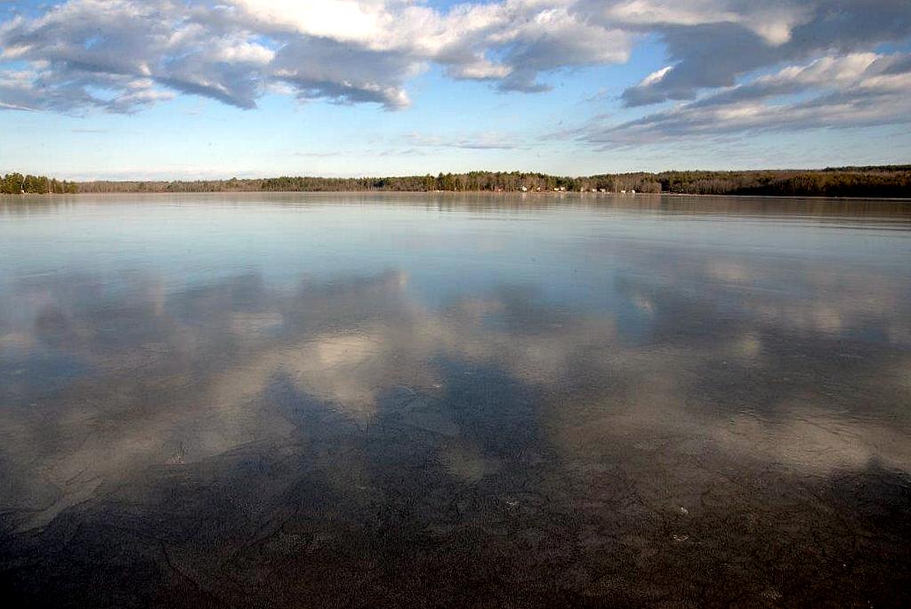 I’ve also posted a few pictures in the Winter 2015 photo album that Tony Marple sent me yesterday, including this one at left that almost could have been taken on a calm summer day. The clouds reflected on the ice show just how smooth it really is. Thank you Tony.
21 December 2014: Two days in the life of Clary Lake, December 2014
Having (almost) nothing better to do for the last few days than put wood in the stove and read, I decided to make a time lapse video with pictures from the Clary Web Cam. The time period covered is December 14th and 15th from 5:00 AM in the morning till 6:58 PM at night with a picture being taken every 2 minutes. It’s pretty exciting stuff. For example, about 12:30 PM on the first day, a water drip runs down the glass and when night falls, you can see a couple of lights on in houses on the other side of the lake 🙂
The technical stuff: the video is composed of 838 pictures being viewed at 24 pictures (frames) per second. That works out to just a hair over 34 seconds of riveting video excitement. You’re welcome 🙂
08 December 2014: Ice-In date of December 6th finally determined
 The official 2014 ice-in date has finally been determined to be December 6th and I have updated the Clary Lake Ice-In and Ice-Out accordingly. While the lake was completely frozen over on the morning of November 29th, more than 1/2 of the lake melted off 2 days later when the temperature rose into above 40° for a couple of days, accompanied with some rain on top of that. Since then the lake has struggled to completely freeze over again until last Saturday morning when it finally seized up tight. Since then it’s put on quite a bit more ice. It was only 5° this morning as the cam pic at left will attest.
The ice isn’t the greatest for skating this year and the weather coming in tomorrow (snow, sleet, freezing rain) isn’t likely to make it any better. We only get really good ice 1 year out of 3 or 4. Here’s another video I found from December 2010 to show you just how good it can get:
November 2014 water level chart archived
November 2014
And so we come to the end of another month. You’ll find the November 2014 water level chart in the 2014 Water Level Charts Album. The lake level stayed in a fairly tight range for the entire month, right around -50″ below the top of the dam, give or take a few inches. It got as high as -48″ at one point and low as -52″ below the top of the dam. With only 2.66″ of precipitation for the month (average is 4.36″) you’d have expected the lake level to have fallen more. However, the ground is fairly well saturated from heavy October rainfall so most of the precipitation we received ran off into the lake. Also, the lake only falls about 1/2 inch per day when it’s at this level so it doesn’t take much precipitation to keep the lake level constant.
And that’s the way it looks from here.
19 November 2014: A little ice around the edge of the lake
Skim ice!
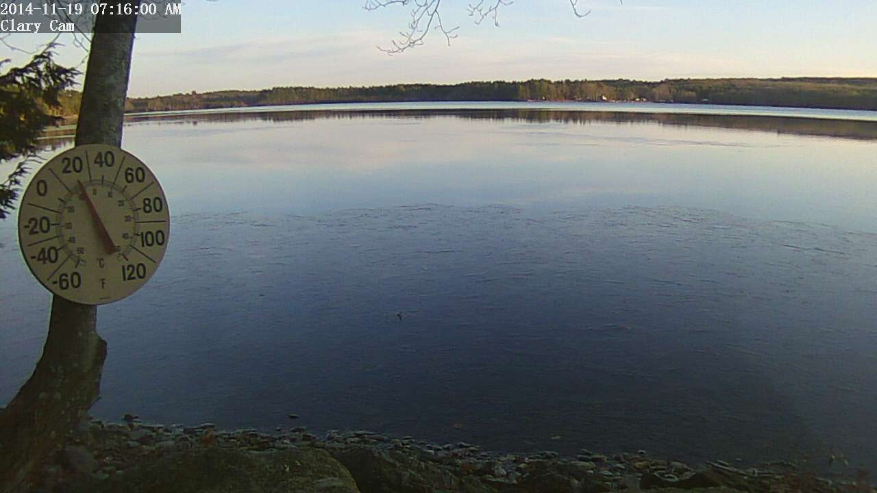
For the first time this fall that I’m aware of, the lake has a little skim ice around the edges this morning. I hadn’t thought the water had cooled off enough to freeze because I was seeing lake-effect warming just the other day. I guess it is ready to freeze up! I remember years ago ice skating over Thanksgiving. I wonder if I’ll get to do that this year? According to our ice-in, ice-out records which go back to 2001, The earliest the lake has fully frozen over was back in 2002, on November 29th though last year it froze over on November 3oth.
04 October 2014: Who says the State boat launch is unusable?
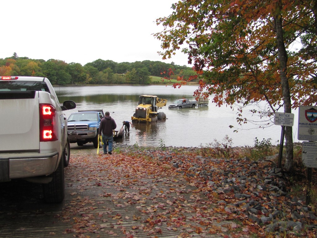 Jack Holland called me earlier today and told me to get over to the boat launch and bring a camera. I didn’t stop to ask questions, I just dashed off. Well, the scene I encountered when I arrived there a few minutes later defied comprehension (see picture upper left). Nonplussed, I decided to just shoot first and ask questions later (you’ll find them in the new Fall 2014 gallery). I also decided to shoot a couple of videos. The first one shows them hauling the Cat loader out of the muck:
I was surprised and impressed those 2 trucks managed to drag that loader out, I’m pretty sure it weighed more than both trucks put together. Then with the loader out of the way, they were able to address the pickup truck problem:
I guess this situation would be funny if it weren’t so tragic. Backing your truck into the lake to get your boat because there isn’t enough water at the end of the ramp was not a great idea, getting stuck was virtually guaranteed. Getting the Cat loader stuck was inevitable once the (bad) decision was made to drive that into the lake to pull out the truck. Then they called dad.
These kids were fortunate really, nobody injured, nothing lost but face. Oh. And a broken drive shaft. And a tow rope. They stirred up a plume of clay sediment (visible in the above video) that will take a while to settle out and they’ve left some ruts in the lake bottom that will be there for years to come, but to put things in perspective, really, the environmental impact of their silly escapade is inconsequential in comparison to that being visited on Clary Lake by the dam owner himself, and through their inaction, the Department of Environmental Protection. Kids will be kids. While it is easy to be critical of their behavior, I can remember doing some pretty stupid things myself when I was young. Nothing like this of course.
03 October 2014: The lake is about as low as it’s going to get
The other day I posted the September Water Level Chart and I speculated at that time that I thought the lake was about as low as it is going to get. Tim Harkins had related how he’d tried to get into the channel and couldn’t find it. Well today I headed out in my kayak to the northwest end of the lake to try to find my way into the channel. I couldn’t. I could see where the water was flowing, but I ran aground in about 3″ of water trying to follow it. I didn’t push it because I didn’t want to get stuck.
The rate at which the lake level has been falling has been dropping off rapidly and as the following plot shows, it has about hit bottom:
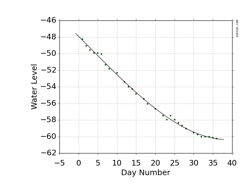
Plot of water level versus day number.
The chart shows 36 days of falling water levels starting on August 16th and extending through today. Now I’m not saying the lake can’t fall any lower, but from the looks of that curve it is unlikely. Theoretically it could drop another couple of inches if we continue without receiving any rain, but that is unlikely. Without any rain, springs and water seeping out of the water table is sufficient flow to offset the 1/8″ per day the lake is falling.
What it interesting is that back in April 2012 the lake level fell to 62.25″ below the top of the dam, 2″ lower than it is now. It is hard to imagine the lake falling that low again. I suspect the sediment “dam” blocking the channel is the result of ice pushing against the lake bottom.
02 October 2014: Another lake shore owner writes State
Another impassioned email this one from Clary Lake shore owner Rick Gallion, confounded by the low water conditions and the apparent lack of any enforcement action being taken against the dam owner by the Department of Environmental Protection. We know from Beth Callahan’s response to Jean McWilliam’s letter from the other day that the State has decided to hold off on enforcement action against dam owner Pleasant Pond Mill LLC pending the outcome of currently ongoing mediation. While this approach is somewhat understandable, it doesn’t make the situation out here on the water any easier to take.
September 30, 2014
Beth,
I wanted to alert you as to the seriousness of the low lake level of Clary Lake. Last weekend I only managed to get my small sailboat out of the lake with great 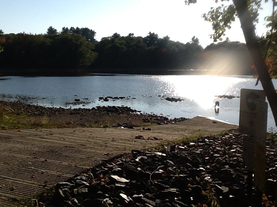 difficulty, and possibly some damage because, as you can see, the level of the lake at the public boat launch is extremely low. A fisherman behind me had difficulty even getting his shallow draft, metal hulled fishing boat out. In the photo of the grassland with the lake in the distance, the water is usually nearly up to the photographer, and the wetland is teeming with wildlife.
There was a family at the boat launch and the children were trying to swim. One of them asked his mom “Where’s the water”. On a day as nice as it was that Sunday, there would usually be several family groups there enjoying the lake.
My wife and I own the Clary Lake Bed and Breakfast in Jefferson, very near the lake. Our business has suffered the last several years because people have stopped 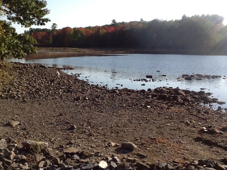 coming to visit families and friends who have camps on the lake. I have been unable to use my sailboat because the level is so low throughout the lake. I only put it in this year so that I could give my nephew from Kansas a sailing lesson, but I was very limited on where I could sail, and I won’t be able to use it until the lake level is restored.
I know that you and your department have been working very diligently on a lake level order for Clary Lake, and I do appreciate your efforts. I also know that 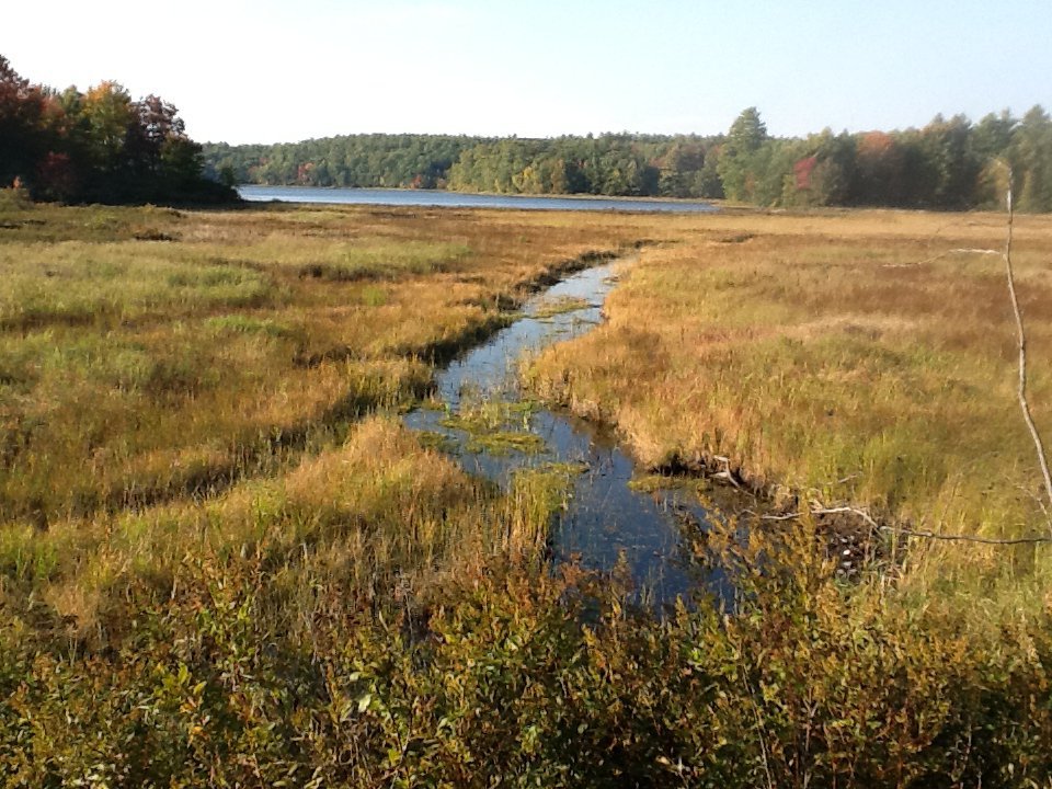 the owner of the property that the dam is on continues to find new and different ways to delay and impede the process. My hope is only to remind you and your department of the negative effects that the mismanagement of the Clary Lake dam has had and continues to have on real people, in hopes that it may encourage you to make every effort to expedite the process, so that Clary Lake will once again be a fine recreation destination for the area, and the state.
Thank you.
Sincerely,
Rick Gallion
Clary Lake B&B
777 Gardiner Road
Jefferson, ME 04348
207 549-5961
01 October 2014: September water level chart archived
 I’ve just archived the September 2014 water level chart… and what a month it was. The effect of only having received 0.95″ of rain for the whole month (average is 3.74″) is painfully evident in the slowly but steadily declining water level over the course of the month. The water level is currently 60.24″ below the top of the dam. It can fall further, but not a whole lot further: an examination of the data used to create the chart shows that the rate at which the lake is falling is dropping off fairly quickly. At the beginning of the month it was falling between almost 3/4″ per day. Now, at the end of the month, it is falling about 1/4″ per day. At that rate, it won’t take much rain at all to offset the drop and the lake will bottom out, and stop falling. Last Friday Tim Harkins told me that he’d tried to get up into the meadow in his kayak but was unable to find the channel.
The likely explanation for the situation Tim encountered is that low water conditions combined with ice over the past couple of winters have caused the bottom sediments in the vicinity of the outlet to be pushed up forming a bar of sediment and that this bar is blocking the outlet channel, impeding the flow of water out of the lake and limiting how low the lake get get. This same mechanism- ice pushing against the lake bottom over time- is likely what created the sand bar that can be seen down by the State boat launch. In that case, there was enough water flowing into the lake to cut a channel through the sand bar. It remains to be seen if there’s enough water flowing out of the lake to do the same thing. I doubt it.
Two years ago the lake got down to 63.25″ below the top of the dam. Realistically I don’t think it can fall that low again, but I might be wrong. In any case I intend to go out and try to find the channel myself, later this week. Stay tuned.