
Everyone have a happy and safe 4th of July!
Everyone have a happy and safe 4th of July!
 I’ve put together a Clary Lake Watershed Survey Base Map using Google Maps and watershed boundaries from the Maine Office of GIS for Clary Lake and Three Corner Pond. The map is basically a proof of concept effort, and a work in progress to boot as I’m still learning how to fit all the pieces together. The next step will be to put the 90 or so records of NPS (non-point-source) pollution sites from the original 2001 watershed survey into a database, geo-reference them with latitude and longitude, add pictures and updated information where necessary, and then finally, import them into the map. Continue reading
 If you’re anything like me, you’ve been annoyed that the Maine office of GIS has not updated it’s Google Earth Parcels.kml file to include the recently completed Whitefield parcels map file. Whitefield parcels have been available for a while as a shape file, but that’s no help unless you have Arcinfo or Arcview. If you wanted to view Whitefield parcels in Google Earth, you’ve been out of luck.
No longer! I managed to get my hands on both Whitefield and Jefferson parcel maps. No need to load in every organized town in Maine, you can just load in the town you want. We’ll be making use of these when we get to work on updating the Clary Lake watershed Survey:
These links will open up in Google Maps. To add them to Google Earth, download them to your computer, then open them in Google Earth and save them to “My Places”. I’ll likely put these under the Charts & Data main menu heading at some point for easier downloading.
[UPDATE] I’ve also separated out the KML files for the Clary Lake watershed and the Three Corner Pond watershed (which flows into Clary Lake):
Clary Lake and Three Corner Pond Watershed (kml) file
These too will be useful when we get to updating the Clary Lake Watershed Survey. Like the Parcel files, these will open in Google Maps. Just download them and open them up in Google Earth, save them to “My Places.”
 June was the second month in a row with significantly above-average rainfall and this has helped keep the lake level up despite the dam owner draining 1.2″ of water out of it each day. It was the 6th wettest June in recorded history! We received approximately 6.13″ of rain, a good 2.6″ more than the average for the month of 3.56″. We started the month at -32.16″ below the top of the dam, fell to a low of -46″ on the 25th and then heavy rains brought it back up 5.5″ to 40.44″ at the end of the month. It we’d received the average rainfall for the month the lake would be at least a foot lower than it is today. It looks like this higher-than-average rainfall trend is going to continue for a little while; I’m torn between wanting more rain to offset the falling lake level and less rain to accommodate more outside activities.
 Back in 2001 members of the Clary Lake Association with the assistance of some DEP staff conducted a watershed survey to identify and catalog sources of non-point source pollution. Typically these were areas where soil was eroding and running into the lake: road side ditches, road shoulders, driveways, unprotected shorelines, unstable slopes, clogged, poorly maintained, or improperly installed culverts, etc. Money for erosion control measures was available under the State’s Nonpoint Source Water Pollution Control Grants (“319”) program. 90 sites were identified and categorized as to whether they were Low, Medium, or High priority and a grant was obtained and erosion control measures were implemented at a number of the high priority site
The NPS pollution and “319” grant program is still in existence today. At this summer’s Congress of Lake Associations’ 43rd Annual Maine Lakes Conference held last Saturday the 22nd at Colby College which I attended, Norm Marcotte of DEP gave a short presentation on DEP’s new NPS Tracker Program which is basically like the old NPS program with added spreadsheet functionality and computer mapping features made possible by such programs as Google Earth and Google Maps.
 Things are heating up for the Branch Pond water level petition. As previously mentioned the hearing has been scheduled for August 23rd. It will be held in China, I believe at the China Elementary School. From what I’m hearing, DEP has made major changes to how they handle and process water level petitions compared to how they’ve run ours. For example, petitioners, interveners, and interested parties are all required to submit sworn and notarized pre-file testimony over a month before the actual hearing, followed by rebuttal comments. The actual public hearing sounds a quite different from what we went through, even a little perfunctory- an opportunity to review and discuss already-submitted comments and testimony. The following is an excerpt from an email I recently received from Brandon Kulik, Branch Pond Petition Spokesperson: Continue reading
 There’s an article in this week’s Lincoln County News by Shlomit Auciello about the State Dam Inspector’s visit to the Clary Lake dams back on the 18th as well as describing the recently released Procedural Order 7. All of this has been covered here. The article is not available online to non-subscribers. Sadly, my printer/scanner fried a few days ago so I can’t scan it and post it. If you want to read the article you’ll have to buy the paper. If anyone out there has a subscription and is willing to “print it” to a PDF and send it to me, that would be appreciated.
[UPDATE] Well it turns out I can’t just live without a printer/scanner/fax so I went and bought an HP Officejet Pro 8600 Plus printer/scanner/fax. It’s sweet. Here’s the article:
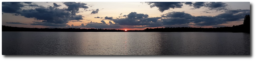
 You know it’s a slow news day when all I got to write about is rain but I’ve been doing a rain dance daily for a while now and it is finally paying off. This afternoon a beautiful storm cell formed up and moved in over Clary Lake and sat there. It’s still there. I just checked my rain gauges (a coffee cup and a dog food can out in the yard) and we’ve already received 1.375″ of rain and it is still raining steadily and shows no sign of letting up. The ground is pretty well saturated so I expect a good amount of runoff on top of yesterday’s rain… and more wet weather is forecast for the next couple of days. Keep an eye on the Current Water Level Charts.
[UPDATE 1] We ended up getting 1.5″ of rain out of that storm. Channel 6 weather report is calling for heavy rains tomorrow, as much as 2-3″
[UPDATE 2] Both David Hodsdon and Tim Chase got more like 0.9″ of rain out of yesterday’s storm, leading me to believe my 1.5″ measurement included “splash” since the rain was coming down pretty violently for a while. Certainly, 0.9″ of rain is more consistent with the lake level rise I observed this morning. I’ll be revising my rainfall amount and altering my make-do rain gauge setup.
[UPDATE 3] Don Norman called to tell me the he too got 1.5″ of rain yesterday. I guess that’s the meaning of “locally higher amounts.” I suspect that the total average rainfall, judging from the lake level rise, was between 1″ and 1.5″
 With the rate at which the lake has been falling lately, it’s a wonderful thing when the downward trend reverses, even temporarily, as it did this morning. Last night’s thunderstorm dropped 0.95″ of rain in a few short hours- a real splasher. This morning the lake had risen 0.07′ (0.84″) since yesterday morning even while it fell 1.2″ in the same period. If we’re lucky runoff will allow this water level to hold for one more day. A good soaking rain is forecast for the end of this week. Is it too much to ask Paul Kelley to close the dam gate to try and keep the water level at a reasonable level for the summer?
I’ve been re-reading the 198 pages of hearing testimony from last August’s public hearing in preparation for diving into my Findings of Fact and Conclusions of Law which are due in a little under 2 weeks. I had started work on them when the transcript was first released late last September and I got some ways in to it before the PPM motion to dismiss brought everything to a sudden halt but there’s still a lot to do to finish. Ms. Parent’s denying my motion to supplement the record with additional material has actually made my job easier, and I’m grateful; considering what has got to get done by July 8th, easier is better and I can do plenty of damage with what’s already in the record.
The outcome of these proceedings is certain and there is nothing Kelley can do to delay things further. Once our closing arguments are in, DEP will begin deliberating. If they are sufficiently motivated, and I have a feeling they are, they could wrap things up in a month’s time and draft a water level order well before the end of August.
 Presiding Officer Heather Parent has issued the Department’s Procedural Order #7. It was sent to the service list (along with an updated service list) by Beth Callahan a little before 4 PM today. First and foremost, the order addresses the recent Clary Lake Association motion filed by Robert Rubin, Association Counsel, calling for a prompt final date for closing arguments:
“Following receipt of this Order, the Department invites the parties to submit final closing arguments about the petition. Closing arguments must be submitted to the Department no later than July 8, 2013 and must be limited to the criteria outlined in 38 M.R.S.A. § 840 (4).”
This is an aggressive schedule, suggesting that DEP is done fiddling around and is ready to get down to business. This works in our favor. Ms. Parent also ruled on my motion to supplement the record with additional information and Kelley’s motion to for a new hearing. She denied them both. I’m content. It would have been nice to get more stuff into the record, but it’s not necessary.
L22585BN DEP Procedural Order #7
Here’s the revised Service List:
 A short and sweet article in this week’s Lincoln County News by Shlomit Auciello about the Clary Lake Association’s short and sweet motion to set a deadline for submission of Findings of Fact and Conclusions of Law. The actual motion was filed by Bob Rubin, counsel for the Association back on June 12th. We have not yet received a response from DEP nor has Kelley filed an objection to it.
 The Summer 2013 issue of the Clary Lake Clarion, the newsletter of the Clary Lake Association, is going in the mail tomorrow morning. As usual it’s being mailed to all Clary Lake shore owners as well as a number of other interested parties. I’m a firm believer that every organization, no matter how well represented digitally, really needs to put out something tangible once in a while to stay firmly in touch with their membership. The plan has been to prepare 2 newsletters per year but in for the past few years it’s been all I could do to get one out in time for the Annual Meeting. And so it is again this year.
I’ve uploaded the newsletter to the site and added it to the Newsletters page under the Membership main menu item. Feel free to download the newsletter and share it with your friends.
[UPDATE] The above link was broken. It’s now fixed. When you encounter a broken link on this site, please email me!
 Tony Fletcher, State Dam Inspector did in fact inspect the Clary Lake dam last Tuesday morning as previously suspected, accompanied by another engineer by the name of Blaine Cardali. Present also were Paul Kelley representing Pleasant Pond Mill LLC and Richard Smith representing Aquafortis Associates LLC. So Paul Kelley got his MEMA dam inspection after all, but he didn’t get the report he was looking for, or much of a report at all, judging from an email sent by Tony Fletcher to Kelley late Tuesday afternoon, summarizing their nearly 3 hour visit to the dam in a few short sentences:
“Regarding the “hazard” of the dam, in my opinion Clary Lake Dam should remain a “low potential hazard dam”. In terms Maine State Law, low hazard dams do not require emergency action plans or remedial action.“
 Edward Grant Jr. passed away at 11:17 AM this morning at his home in Baton Rouge, Louisiana surrounded by his family. There are no more details available at this time.
Edward Grant Jr’s obituary is now online:
It is also linked to a page under the Membership main menu heading called “Past Members No Longer With Us” and there is also a donation page where you can donate money to the Clary Lake Association in his memory, if you are so inclined. There is also a place at the bottom of the page to leave a comment.
 The Whitefield informant network is alive and well- little can transpire in the town of Whitefield that isn’t observed by at least one person who spends at least part of the day hanging out at the Whitefield Superette, drinking coffee and holding office. According to several reports, there was a gathering of folks at the dam for a couple of hours yesterday morning, from about 9 AM to a little after 11 AM. Paul Kelley and Richard Smith were there, and one or more people “from the state” judging from their description. They were reportedly standing on the road and pointing at the dam when observed by one passerby.
I suspect it was most likely Tony Fletcher, State Dam Inspector with the Maine Emergency Management Agency (MEMA) since according to Paul Kelley, he’s the only person in the State qualified to point at dams. Certainly nobody at DEP is qualified to point at dams. I’m not qualified to point at dams. Kelley can point at his dam of course.
I’ll try to confirm this but it sounds like Kelley managed to convince MEMA to come out and do another dam inspection, which is not really surprising considering the big stink Kelley created around this issue. I’ll simply remind everyone: the condition of the dam impounding Clary Lake is not relevant to the determination of a water level for the lake. Period. End of discussion.
 Many of you have no doubt seen the recent articles in the Newpapers (Portland Press Herald, KJ, etc.) about DEP’s alleged “speak no evil, see no evil, hear no evil” approach to environmental regulation these days as in “looking the other way”, “sitting on their hands and doing nothing”, and generally “dragging their feet” on various issues. The allegations mostly involve land use and chemical industry issues with Big Money behind them. The highlight of the first article is how DEP failed to meet a deadline for submission of documents related to water levels associated with a hydropower licensing action on Long Falls dam on Flagstaff Lake, to the decided detriment of the town of Eustis. DEP claims it was an oversight. Here’s part 1 and 2 of a 3 part series:
Here is another article along the same vein by the same reporter, Colin Woodard:
The paper has printed an editorial (on the front page even) which is pretty good:
[mw-ip-deny deny=”76.179.6.54,71.173.72.205″]For those of you who attribute lack of movement on the Clary Lake water level petition to DEP intentionally dragging their feet, I disagree. There is one very good reason why this petition is taking so long: one very loud and ornery man with a grudge: I blame Paul Kelley for the delays, plain and simple. There is no “Big Business Lobby” on the other side of this petition to explain why things are taking so long. [/mw-ip-deny]
 The water level chart update mechanism is broken. I’d hoped to get it fixed over the weekend but I guess I have to write a new script and I really don’t have the time right now. Sorry for the inconvenience. I’ll fix it when I get a chance. In the meantime, if you want to know what the water level of the lake is, go out and take a look!
UPDATE: Temporarily Broken Subsystem Permanently Fixed. I guess it wasn’t really broken in the first place.
 I finally got around to building a dock today, down on my shoreline. In years past I’ve had floats off shore but I’ve never had a dock on legs. It’s designed so that as the water level varies I can just pick it up and move it in or out. It’s not for tying my boat up to, I’ve already got one of those over at the farm house. This is for sitting on, drinking coffee on, reading on, napping on, fishing from, and swimming off of, and anything else that involves not really doing anything. It’s (currently) deep enough to dive off the end of it if you dive shallow. If you see someone sitting on it, swing by and say hello.
I received a call from Ed Grant’s daughter Kate Seba last night, she called to let me know that Ed is not doing well and is not expected to live much longer. She’s asked for us to keep him in our thoughts and in our prayers. Ed has been an active and valued member of the Association for a long, long time.
 Robert J. Rubin, counsel for the Clary Lake Association has filed a motion with the Department of Environmental Protection requesting the Hearing Officer set a “prompt final date for submission of the proposed Findings of Fact and Conclusions of Law of the Public Hearing from August 17, 2012.” The Association feels that these petition proceedings have gone on entirely too long and it’s time for some substantive action on the part of the Department. It is hoped this short and sweet motion will spur the Department to move quickly and decisively in the right direction on this matter.
I commend Bob Rubin and through him, the Association, for taking this assertive step.