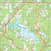
 Our Watershed Steering Committee has begun planning the 2024 Watershed Survey, with the assistance of DEP Staff. This is not our first watershed survey, the picture at left is the actual Clary Lake watershed map developed for the 2001 watershed survey. While the watershed itself hasn’t changed in 22 years, a lot of land development has occurred in those intervening years. It is way past time to take this important step in protecting and preserving Clary Lake and its water quality.
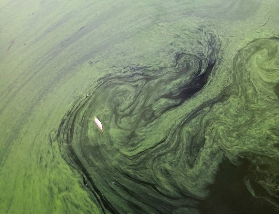
The purpose of a watershed survey is to identify sources of non-point source pollution- areas where soil erosion is taking place within the watershed such as along shorelines, gravel driveways, camp roads, road side ditches, dysfunctional culverts, etc. Runoff from rainstorms and snowmelt can result in soil erosion and sedimentation which makes its way into the lake, bringing with it sediment and nutrients, the most damaging of which is Phosphorus. If you’ve been paying attention over the years, you’ll know that Phosphorus is the primary cause of algal blooms and If we want to keep our lake free of blooms (see picture at the top of this post), we need to reduce the amount of Phosphorus entering the lake. A watershed survey is the first step in doing that.
Once we’ve completed a watershed survey and have developed a Watershed Plan, we become eligible for Nonpoint Source Water Pollution Control Grants. DEP administers Nonpoint Source (NPS) grants to help communities make progress restoring or protecting waters named as NPS Priority Watersheds (Nonpoint Source Priority Watersheds List). While Clary Lake is not listed as an “Impaired” lake, it IS on the list of Threatened Lakes, making it eligible for 319 funds- a dubious distinction but an important one! Grants for projects are funded with monies provided to DEP by the U.S. Environmental Protection Agency under Section 319(h) or Section 604(b) of the Clean Water Act.
Volunteers Needed!
We’re going to need roughly 15 volunteers to help with the actual field work of the survey. The plan is to divide the watershed into 4 roughly equal sized sectors and assign each sector to a survey team consisting of 3-4 volunteers and a Technical Specialist who will oversee and guide the survey fieldwork. It is anticipated that the actual field work will take approximately one day to complete. It will obviously be a long day! Food and refreshments will be provided.
The survey is to take place on Saturday May 4th (rain date, Sunday May 5th). Volunteers will need to attend a Zoom training session held a week or two before the survey. The training will be offered several times to accommodate varying schedules. To volunteer to help with the watershed survey field work or to volunteer in any other capacity on this important project, please email watershed@clarylake.org or call George Fergusson @ 207-242-2256. If you have any questions at all about the survey or why we’re doing it, please do not hesitate to contact us!

