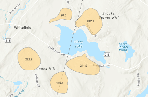
 The State of Maine has released a new map using the ArcGis mapping platform to show the state of the Browntail Moth infestation in Maine this year. Last year’s outbreak of the pest was the worst every seen in Maine, and it looks like this year will be very bad again. However, it looks to me like some of the areas that were hardest hit last year (including my property!) may experience less of a problem this year. My property on Clary Lake is surrounded by large red oak trees, and last year ALL of them were completely defoliated for the second year in a row. I feared a third year as bad as the previous two would doom many of my trees. I’m happy to report however that this year I’ve only spotted 1 caterpillar on my screen door and no evidence at all of caterpillars eating the emerging oak leaves. My fingers are crossed, it looks like we won’t suffer a repeat of the last two years this summer.
I’ve spoken to a number of Clary Lake shore owners, some of them are reporting serious infestations again and some, like me, are seeing fewer Browntail moth caterpillars this year. In many ways, last summer was a “lost summer” for many of us in terms of quality yard-time. I know I didn’t spend much time sitting around the camp fire last year, or hanging out on our deck! Hopefully this BTM infestation will burn itself out soon.
In the map section above, the shaded areas represent BTM by aerial detection spring 2021:
