 Paul Kelley has fulfilled the final statutory requirement of his Petition for Release from Dam Ownership or Water Level Maintenance by filing his consultation report detailing the results of his attempts to find a new owner for the Clary Lake dam. This concludes a process that he started over a year and a half ago. He filed the report late last Friday afternoon, 19 September 2014. I obtained copies of the report from the Department of Environmental Protection earlier today. I haven’t had a chance to read these reports yet, but I’m certain he will state that he’s met all the statutory requirements of the law, has found no one willing to assume ownership of the Clary Lake dam:
- Consultation Report 19 September 2014 (8 pages)
- Addendum to Consultation Report 19 September 2014 (24 pages)
Of course, it’s a well-known fact that the Clary Lake Association would like to own the Clary Lake dam. However, anyone who has been on the receiving-end of Kelley’s sales pitch can only conclude that he really doesn’t want to sell it at all. Kelley’s petition has been written about numerous times on these news pages; if you want to find them select the category “That Other Petition” in the right side bar, or follow this link.
 Virtually all of the natural characteristics of a lake are influenced by the land area, or watershed, that drains to the lake. But human activities that alter the natural protective features of lake watersheds can result in significant degradation of water quality and aquatic habitat over time, unless conservation measures are undertaken to protect the lake. This workshop will cover basic information about the relationship between lakes and their watersheds, common threats to lake water quality from watershed development, and how to identify and resolve problems through the watershed survey process. We will begin with an inside discussion, followed by a field trip to a nearby lake watershed.Please bring a brown bag lunch.
  The Whitefield Selectmen have sent a letter to Assistant Attorney General Thomas Harnett, the person handling the Clary Lake water level order and its pending appeal filed by Paul Kelley in Lincoln County Superior Court. The letter urges the AAG to expedite the current mediation process and enforce any violations of the water level order that may be found to exist. It was sent by email to the Service List. It has also just been posted on the Town of Whitefield’s
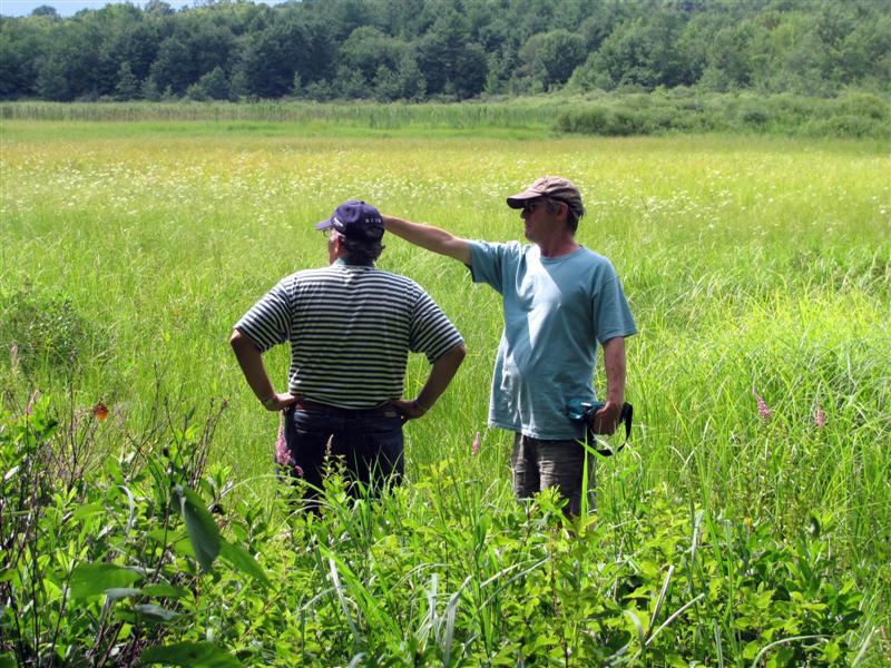

 Some of you might have noticed a change to the link structure in use on our website. The original “?page_id=266” and “?p=2243” links have been replaced with a human readable “post-name.” For the most part this will be transparent and not require any thought or action on your part. If you have links you’ve saved in your browser for favorite pages, they’ll still work, you’ll just be automagically redirected to the new link. For example, if you point your browser at:
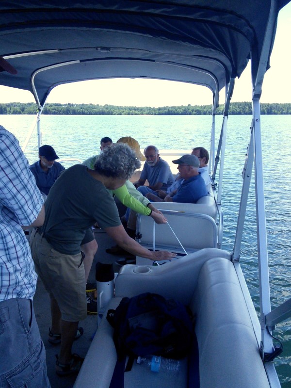
.png) We had a good meeting of the Clary Lake Association yesterday, reasonably well attended though I had expected a somewhat larger turnout given how much we promoted the meeting. I remain somewhat chagrined that so many Clary Lake shore owners either aren’t interested in joining the Association or just can’t be bothered. I’m also surprised that some folks actually show up for the meetings, but are still unwilling to join! What’s up with that? The Clary Lake Association is
We had a good meeting of the Clary Lake Association yesterday, reasonably well attended though I had expected a somewhat larger turnout given how much we promoted the meeting. I remain somewhat chagrined that so many Clary Lake shore owners either aren’t interested in joining the Association or just can’t be bothered. I’m also surprised that some folks actually show up for the meetings, but are still unwilling to join! What’s up with that? The Clary Lake Association is  The Clary Lake Association Annual meeting is
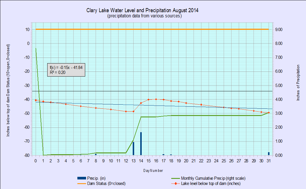
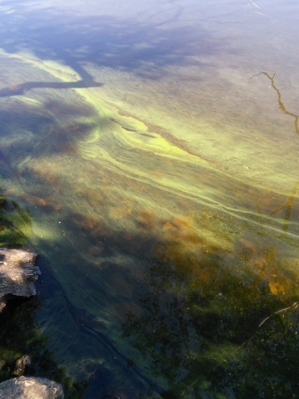
  Jack Holland and I performed out bi-monthly water quality monitoring boat trip this morning and obtained a secchi disk reading of 1.80 meters (5.9′) indicative of an algae bloom in progress. This does not come as a huge surprise since we’ve entered a bloom state about this time of year for the past 4+ years. Still, it was an unpleasant discovery. I’ve posted today’s data on the
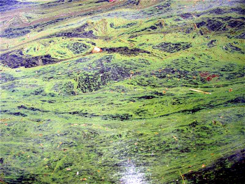
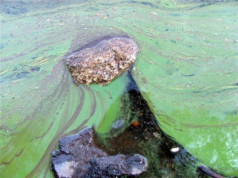
 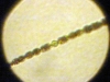 Algae blooms are caused by the out-of-control growth of blue-green algae known as cyanobacteria. The most common cyanobacteria is Anabena, shown at left. Algae feeds primarily on phosphorus washed into the lake by runoff and released from bottom sediments in low-oxygen conditions. Undoubtedly the 7.65″ of rain and the resulting runoff we received in July contributed to this bloom, but the lower water levels resulting in reduced lake volume and sediments exposed to wave action and erosion certainly didn’t help any. Here are some pictures of what we can look forward to in about 2 weeks:
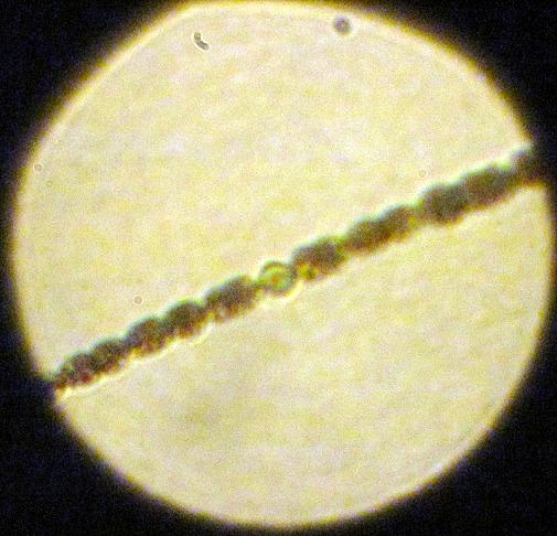
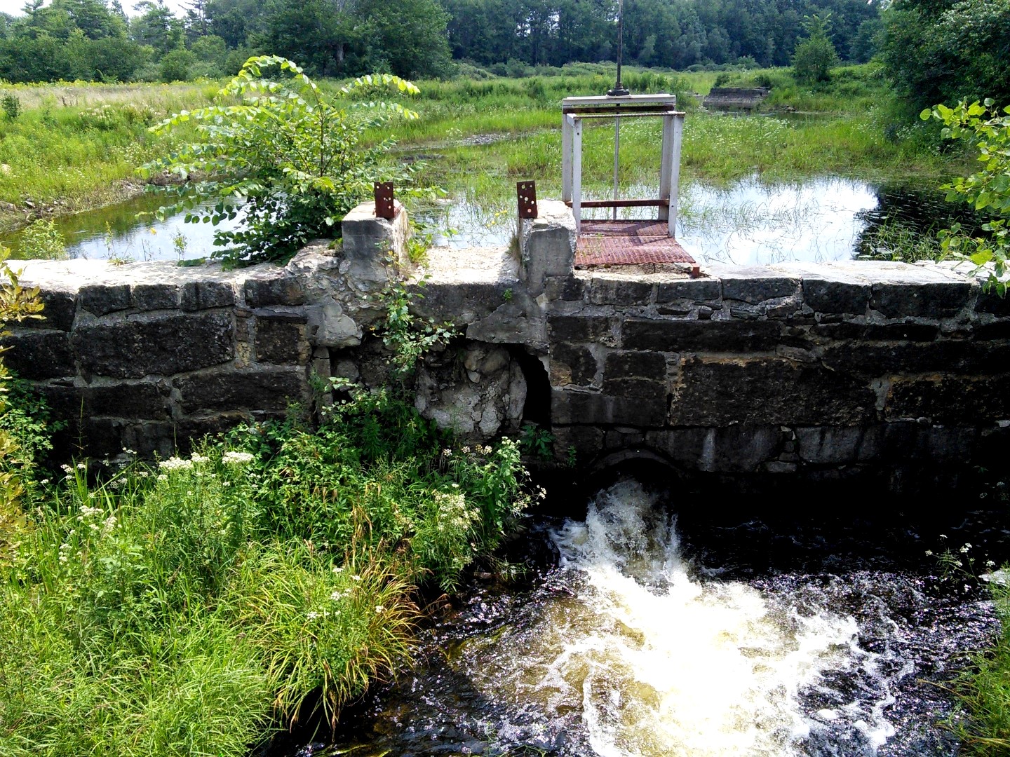
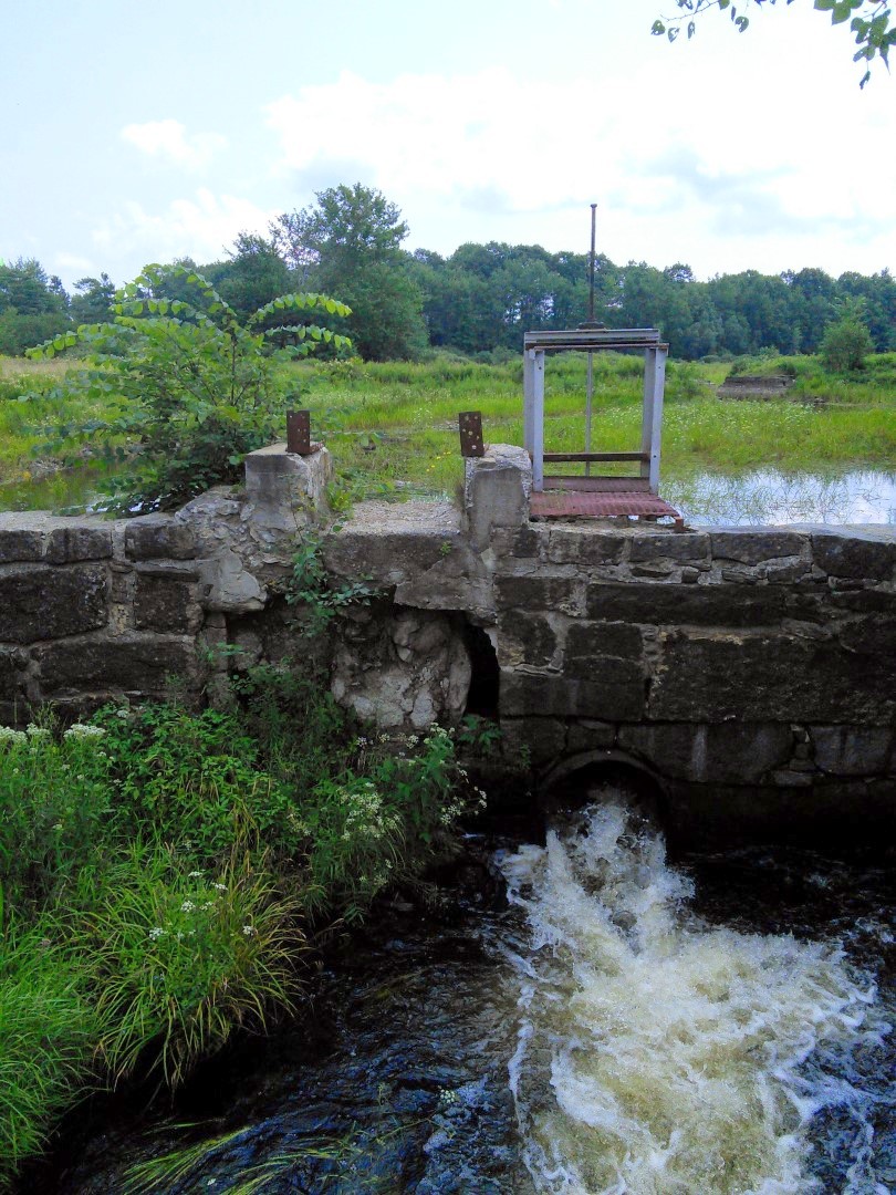
 Special Condition #4 of the

 There was an article in yesterday’s Kennebec Journal by staff writer Paul Koenig providing a welcome update on the current circumstances surrounding the Clary Lake water level order. It is nice to see the KJ keeping this issue before the public, rather than letting it fade into obscurity. Paul Kelley was quoted as saying that mediation is to start at the end of this month and that the process is likely to extend into August: “My hope is that all the parties see that the best solution is no longer to fight this but to try to see if there is some constructive solution.” Nonetheless, the spokeswoman for the department said the DEP still expects the dam owner to begin maintaining the higher water levels by Oct. 1. Here’s a link to the article:
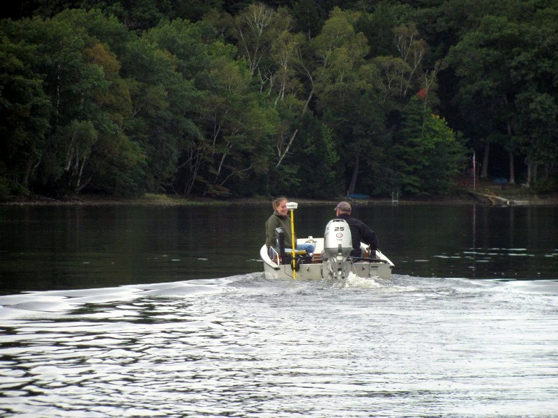