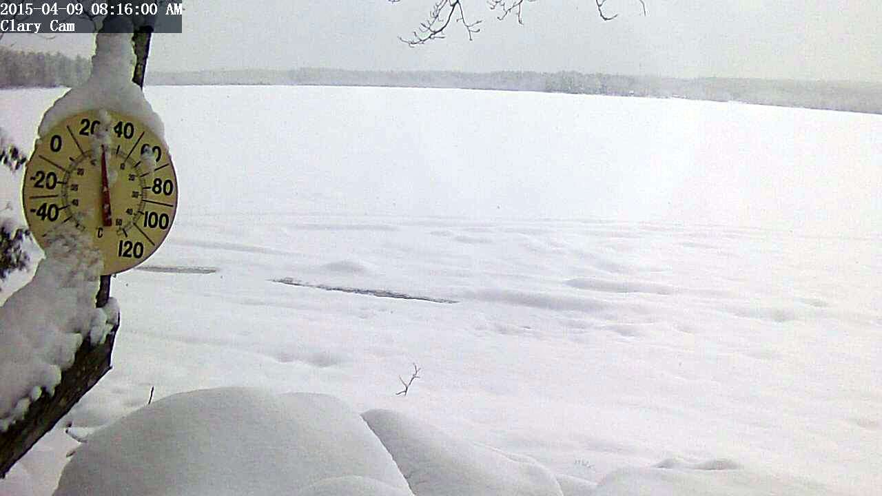
This was April 9th, lake fully covered with ice and 6″ of new snow:
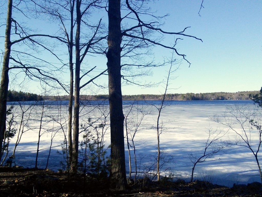
This was yesterday, 9 days later, snow all gone and half the lake open:
This was April 9th, lake fully covered with ice and 6″ of new snow:
This was yesterday, 9 days later, snow all gone and half the lake open:
“Waking up to 6″ of new snow today was a little better than a sharp stick in the eye” George Fergusson announced at the Whitefield Superette this morning. “but the expression on my wife’s face when she looked out the window was truly pitiable.” George’s recommendation is to get out and make one final snow man before tomorrow’s rain and this coming weekend’s 50° plus temperatures turn today’s winter wonderland into tomorrow’s quagmire of mud. “Before you know it you’ll be doing yard work with a cloud of black flies around your head. This is just a temporary setback.”
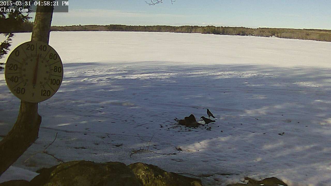
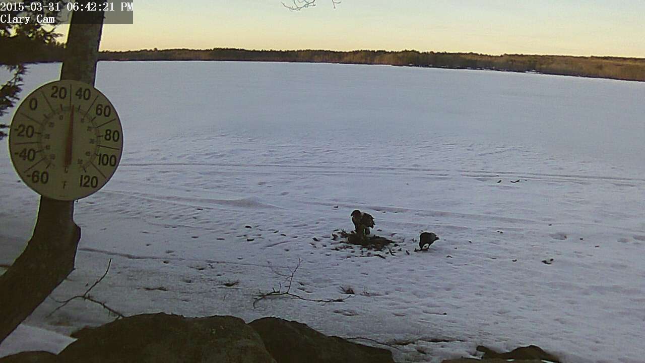
The immature Bald Eagle that showed up to feed on the turkey carcass yesterday afternoon came by again this morning. I got this video of it feeding.
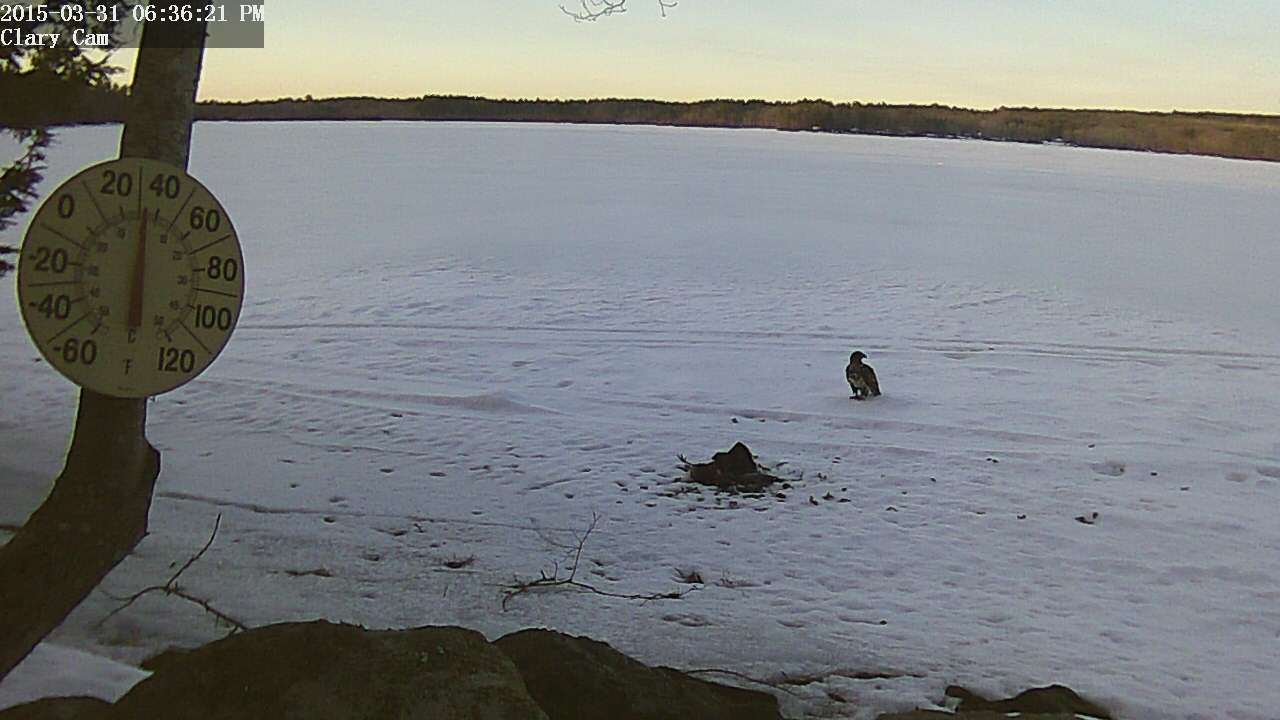
UPDATE: A little later in the morning, an adult Bald Eagle showed up to feed on the turkey carcass. There was actually a second adult that never came down to the ice. Eventually, they flew off with what was left of the turkey carcass.
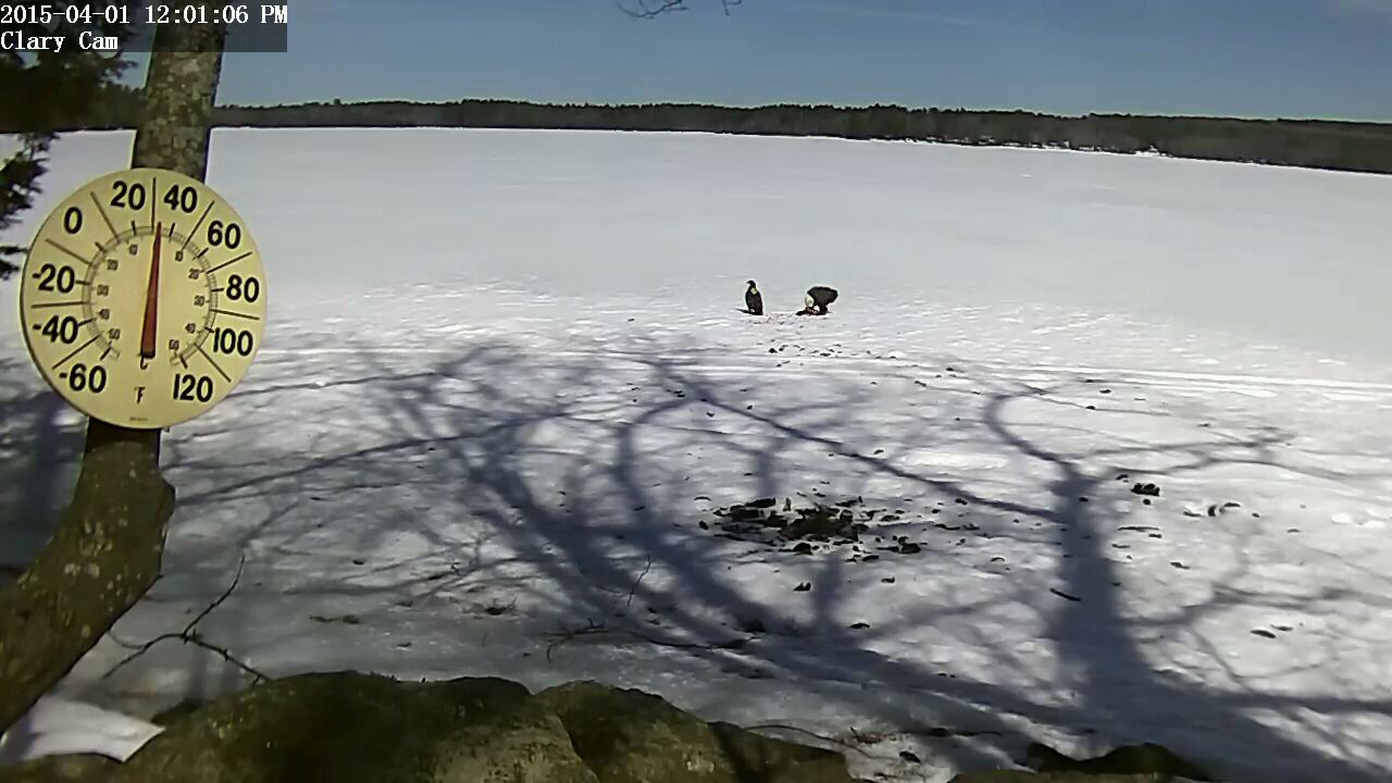
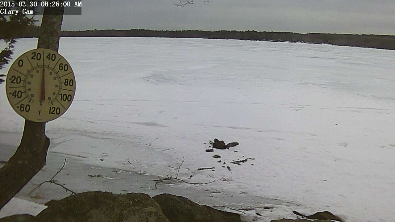 I got a call the other day from a neighbor telling me that he’d hit a wild turkey right in front of my house. I went out and retrieved the carcass and decided to put it out on the ice in front of the Clary Webcam so we could all enjoy watching wild animals tear it apart. My son’s dog already discovered it last night and started the process of pulling feathers out. I imagine the Ravens will make short work of it assuming a fox or coyote doesn’t come along and haul it off in the night. Maybe an eagle will show up.
You’re welcome 🙂
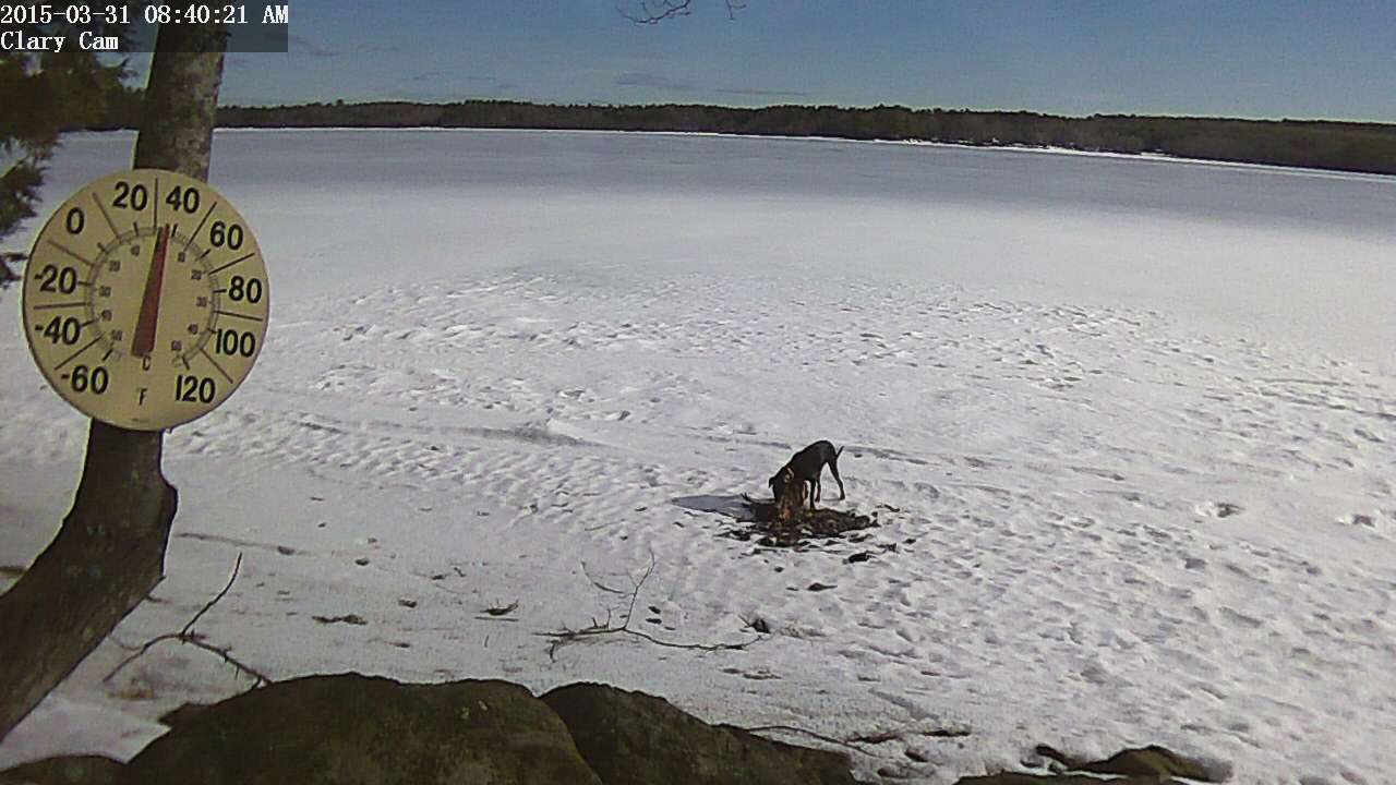
UPDATED 31 March 2015:
Visitors today to the turkey carcass included my son’s dog Emma (again), several ravens, and an immature Bald Eagle.

Paul Kelley (left), of Pleasant Pond Mill LLC, and Richard Smith, of Aquafortis Associates LLC, speak about the non-payment of property taxes at the Whitefield selectmen’s meeting Tuesday, March 24. (Abigail Adams photo)
There is an article in this week’s Lincoln County News by reporter Abigail Adams about the Town of Whitefield waiving automatic foreclosures on property belonging to Aquafortis Associates LLC and Pleasant Pond Mill LLC. The article includes a lot of background information with the only obvious error being that it indicates the 2 parcels owned by Aquafortis Associates are “downstream” from the dam whereas in fact, they are on opposite sides of Route 218; the 1 acre vacant lot is actually located on the same side of the road as, and on the south side of, the Clary Lake dam.
Here’s a link to the article on the Lincoln County News site (I will archive a copy of the article in a few days):
I posted about this story last week; see: 19 March 2015: Whitefield votes to waive automatic foreclosures on PPM, AQF properties.
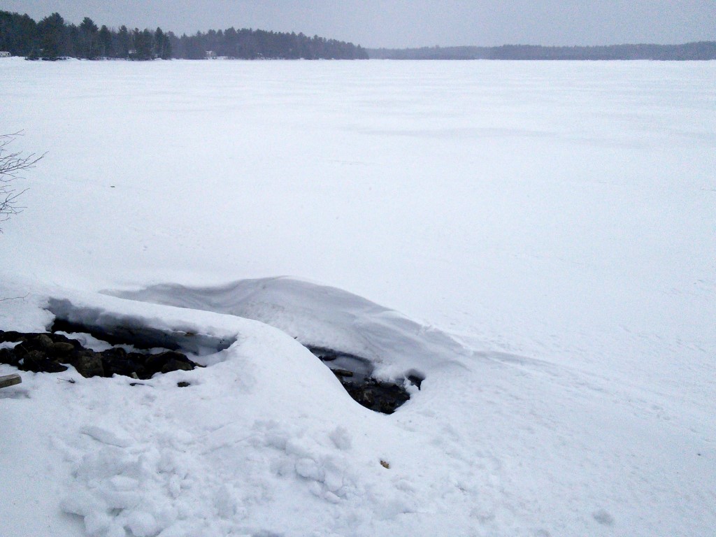 Today I took a walk down to the lake and noticed that melting snow had exposed a small section of ice on the shore so I got a shovel and dug down through 3′ of drifted snow to uncover my bench mark and made the first accurate water level measurement since the end of January. The lake level is currently at -54.65″ below the top of the dam, about 1/2 a foot lower than I had estimated it to be a couple of weeks ago and 8.57″ lower than it was on January 31st when I last measured it.
At a hastily convened Emergency Select Board meeting held this afternoon at 5:00 PM at the Whitefield fire station, the Whitefield Select Board voted 3-0 to waive the pending automatic foreclosure of property belonging to Aquafortis Associates LLC. Present at the meeting were Select Board members Tony Marple, Dennis Merrill, and Frank Ober, and Town Clerk Aaron Miller. There were only 5 people in the audience including Paul Kelley of Pleasant Pond Mill LLC.
The tax liens were for non-payment of 2013 Whitefield property taxes on two lots of land belonging to Aquafortis Associates: the Clary Mill property (and mill building) on the west side of the road (tax map 17 lot 004A) with a lien on it in the amount of $752.64 and the approximately 1 acre of land on the east side of the road adjoining the Clary Lake dam on the south (map 17 lot 055B) with a lien on it in the amount of $595.40. The total amount due for both properties was $1348.04. The automatic foreclosures were set to take effect at 3 PM tomorrow afternoon. Aquafortis Associates also owns the red building sitting on the Clary Lake dam but the taxes on that have been fully paid. Tax maps and property assessment data are available on the Town of Whitefield website.
There was little discussion and the meeting was over almost before it started. The Selectmen did not give any reason for their decision to waive automatic foreclosure of the Aquafortis Associates properties other than to state that they were acting on the advice of the Town’s attorney, Mary Denison of Lake & Denison LLP in Winthrop Maine.
The selectmen had previously voted at a regularly scheduled Select Board meeting a few weeks ago to waive automatic foreclosure of the Clary Lake dam property belonging to Pleasant Pond Mill LLC, also for non-payment of 2013 property taxes. That tax lien was for $208.10.
There are outstanding tax liens on PPM and AQF properties for non-payment of the 2014 taxes. Those liens will go to automatic foreclosure in about a year if the taxes are not paid.
.jpg) Paul Koenig of the Central Maine Papers (Kennebec Journal, Morning Sentinel) has written an article that appeared in this past Saturday’s paper. There has been precious little news in recent months about the Clary Lake water level order and the ongoing mediation. Sadly, while it is good and generally accurate reporting, there’s not a lot of new information in the article.
Paul Koenig of the Central Maine Papers (Kennebec Journal, Morning Sentinel) has written an article that appeared in this past Saturday’s paper. There has been precious little news in recent months about the Clary Lake water level order and the ongoing mediation. Sadly, while it is good and generally accurate reporting, there’s not a lot of new information in the article.
I’ve archived a local copy should anyone have trouble getting the article off the paper’s site.
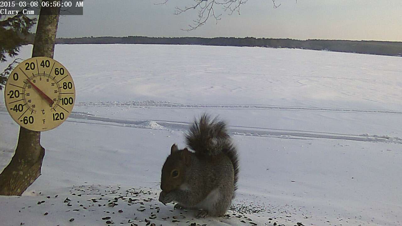
The Clary webcam is now a wildlife cam simply by spreading some black sunflower seeds in front of it. It seems awfully large for a Gray Squirrel doesn’t it?
 Robert Frederico Antognoni
1925 – 2015
JEFFERSON – Robert Frederico Antognoni, 89, died peacefully at his home on Clary Lake, surrounded by his loving family on Wednesday, March 4, 2015. Robert was born on Aug. 22, 1925, in Concord, Mass., to Secondo and Ersilia Fraticelli Antognoni, who had both immigrated to the United States from Fano, Italy. Continue reading…
Friends are invited to memorialize Bob and his life at Staples Funeral Home in Gardiner. Visiting hours will be 4-7 p.m., Sunday, March 8. A Mass will be celebrated at 11 a.m. on Monday, March 9, at St. Denis Catholic Church, North Whitefield. A reception to commemorate his life will immediately follow the service at the St. Denis Parish Hall across the street.
I got a message from Mary Hornecker just a bit ago that her father Bob Antognoni passed away early this morning, at home, surrounded by his family. He was 90 years old. There will be an obituary in the paper this Friday and the funeral is planned for next Monday. Details of the arrangements will be posted here when they become available. Mary sent the this recent photograph of Bob. Bob was a long time member of the Clary Lake Association, a dedicated and faithful steward of Clary Lake, and a good friend. He will be missed. Please join me in wishing his family strength and peace at this difficult time.
I hunted around the site and found this picture of Bob in our Historical Photographs album. The picture shows Bob putting out Loon Nesting signs, sometime around 2002.


At the end of the description of the above picture there’s a link to a full sized version (or click here) on which you can easily see dark stain on the abutment representing the approximate normal high water line, about 1′ below the top of the abutment.
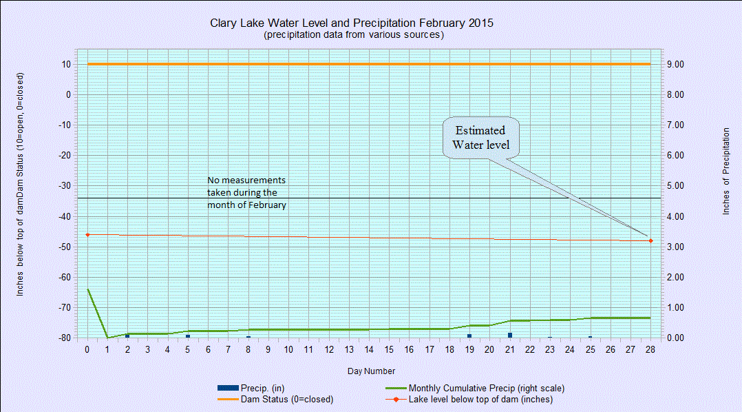 I also added a chart for February 2015 (using precipitation data from the Weather Underground) to the 2015 archive more or less for a place holder since there really isn’t much to look at on it, and I updated the Current Water Level Charts page with a rudimentary chart for March. I’ll try and get an approximate water level more or less weekly until conditions allow me to resume regular measurements. I expect when our awesome 48″ snow pack melts we’re going to see a substantial rise in the lake level.
While I was at it, I corrected the mislabeled January 2015 water level chart which unfortunately claimed to be for December 2014. Nobody noticed, or else nobody bothered to point it out to me.
Think spring!
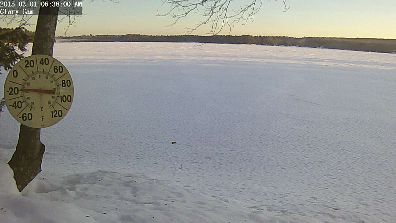 It was a clear and cold -15° F this morning when I got up, pretty chilly for the 1st day of March. As cold as it has been this winter, it appears the channel has remained open. You can see in the web cam image from this morning that there is some fog up in the northwest end of the lake where the channel starts. This indicates open water. I’ve seen this phenomena off and on this winter when conditions were right. Sure hope the weather starts warming up soon.
I had hoped to resume water level measurements today but the weather is going to have to moderate a lot and a whole load of snow is going to have to melt before I venture down to the lake. There’s easily 6′ of snow on my shoreline and I have no inclination to try floundering through that to find the ice, and then have to chop a hole in it, find my bench mark, yada yada. I will make a point of swinging by the dam today and guestimate the water level at the railroad abutment, that should give us an idea within a few inches of what the lake level is.
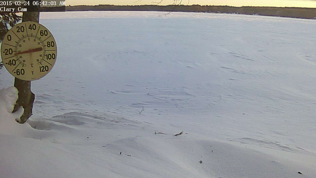 It was -27° this morning on Clary Lake, according to 3 different thermometers. Now that’s bracing! If you feel like it’s been a cold month, you’re right. According to the National Weather Service at Gray, Maine, this has been the coldest February on record with an average temperature of somewhere around 13° (record keeping began in 1940). Sure seems like the temperature has been below 0° every morning since sometime in January.
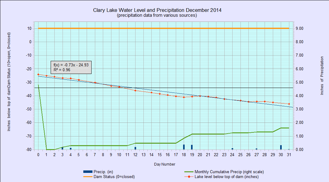 And so we come to the end of another month. I’ve archived the first chart of 2015 in a new album “2015 Water Level Charts.” Due to heavy rains in December combined with frozen ground, significant runoff brought the lake level up to 24″ below the top of the dam at the start of the month, right where it would be this time of year if the water level order were being followed. The water level has steadily fallen since the 1st of the year and ended the month at 46″ below the top of the dam.
Like last year, I have decided to halt further water level measurements for the month of February. Weather permitting I’ll resume water level measurements on or about March 1st.
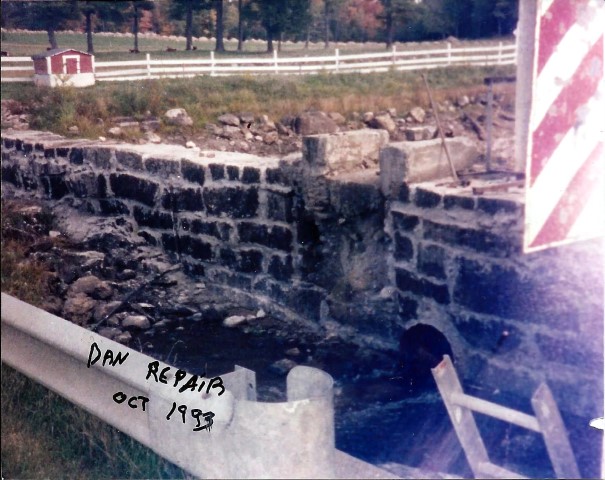 Jane Chase came across 5 old photographs showing repairs being made to the dam back in the fall of 1993. I’ve scanned them and added them to the Chase Family Archive. Art Enos subsequently bought the dam in February of 1995. I recall when the work was being done, the mason Ron Bourassa was a friend of mine and I remember stopping by a few times to watch what was happening. One of the new photographs shows Steve Schlosser who was Ron’s tender on that job. The 5th & last photograph shows someone removing sand bags from the stream
  with a backhoe while dismantling the coffer dam that had been constructed at the narrow gauge railroad abutments. Some of those sand bags are still in the stream as can be seen in the photograph at left, taken by me in the Spring of 2012.
I’d like to thank Jane (again!) for providing these photographs and encourage anyone with old photographs taken on or around Clary Lake to please send them to me.
Recreation opportunities abound on Clary Lake this winter, apparently. While the rest of us were ice skating down in the west end of the lake, David Knight was out doing donuts on his riding lawn mower with his faithful companion Megabyte:

Comet Lovejoy is well placed for convenient, early evening viewing. It’s bright enough to be visible to the naked eye but I recommend at least binoculars to get a good view of it. The finder chart below shows the comet’s location on the evening of January 10th. If you can find Orion, you can find the comet. It’s moving fairly rapidly in a northerly direction and getting higher in the sky all the time. On the 17th, it will be just south of the Pleiades.

Here’s a Sky & Telescope article with finder charts and photographs.
 The ice skating on Clary Lake has been extraordinary this year, and a good many people have taken advantage of the fabulous conditions. This afternoon I was out skating and encountered 4 people from Waldoboro (at left) who’d heard about the excellent skating conditions on Clary and came by to see for themselves. They were suitably impressed. Unfortunately the snow, sleet, and freezing rain storm coming in tonight will likely put an end to skating this winter. Here’s a video I shot this afternoon.
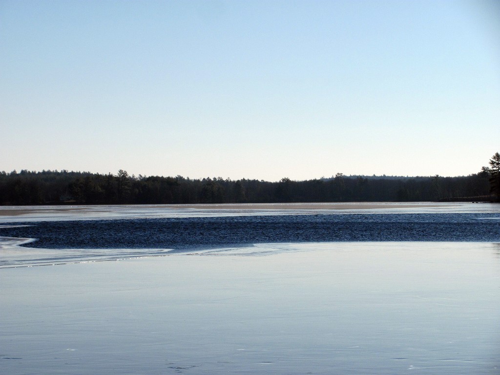 A word of caution: despite the low temperatures, there is still a considerable amount of open water out in the middle of the lake, (see video above) and a few open or mostly open leads around the shore where you wouldn’t expect to see them. This condition is due to a combination of the relatively high water level (2′ below the top of the dam) and a strong current resulting from the dam’s gate being wide open (the lake level is dropping about 1″ per day now). The current flows in a generally straight line from the inlet by the State boat launch passing close by the point at the end of the Duncan Road, to the outlet channel at the northwest end of the lake. The channel itself is ice free as well. The picture at left was taken New Years Day and the open area has gotten considerably larger since then.
This condition has occurred several times in the past few years. These open areas will probably fill with slush from the coming storm and skim over without getting really solid. Snowmobilers and skiers beware: if you don’t know where the safe ice is, you’d best stay close to shore or off the lake altogether.
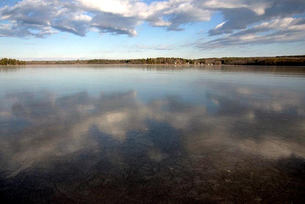 I’ve also posted a few pictures in the Winter 2015 photo album that Tony Marple sent me yesterday, including this one at left that almost could have been taken on a calm summer day. The clouds reflected on the ice show just how smooth it really is. Thank you Tony.
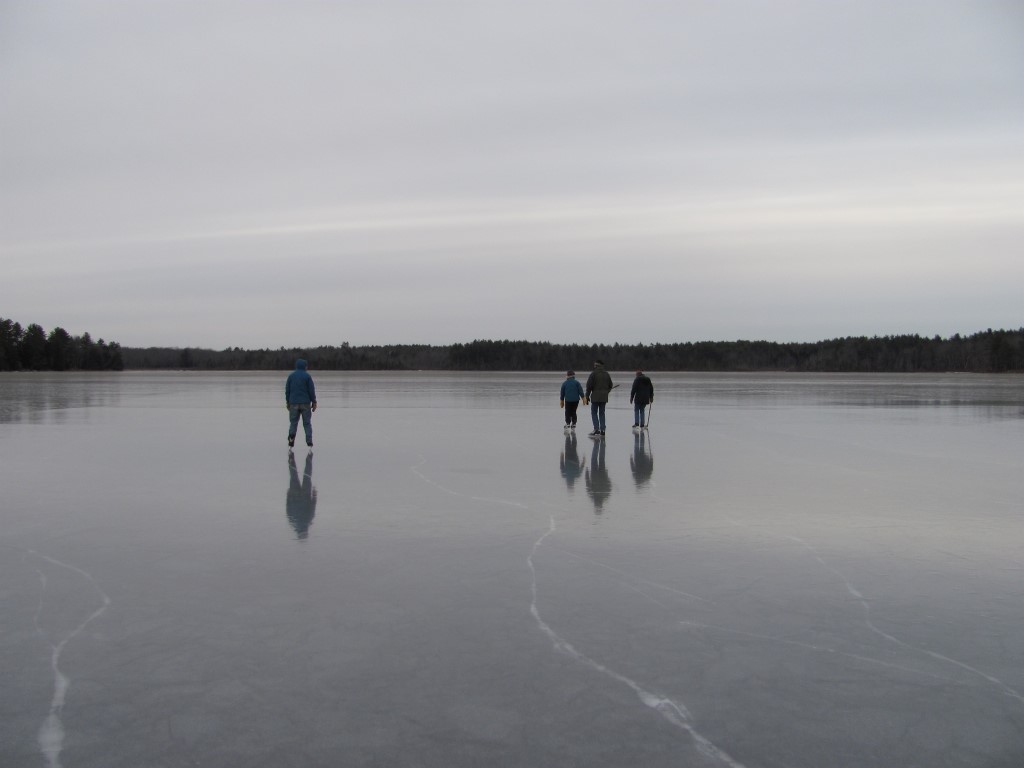
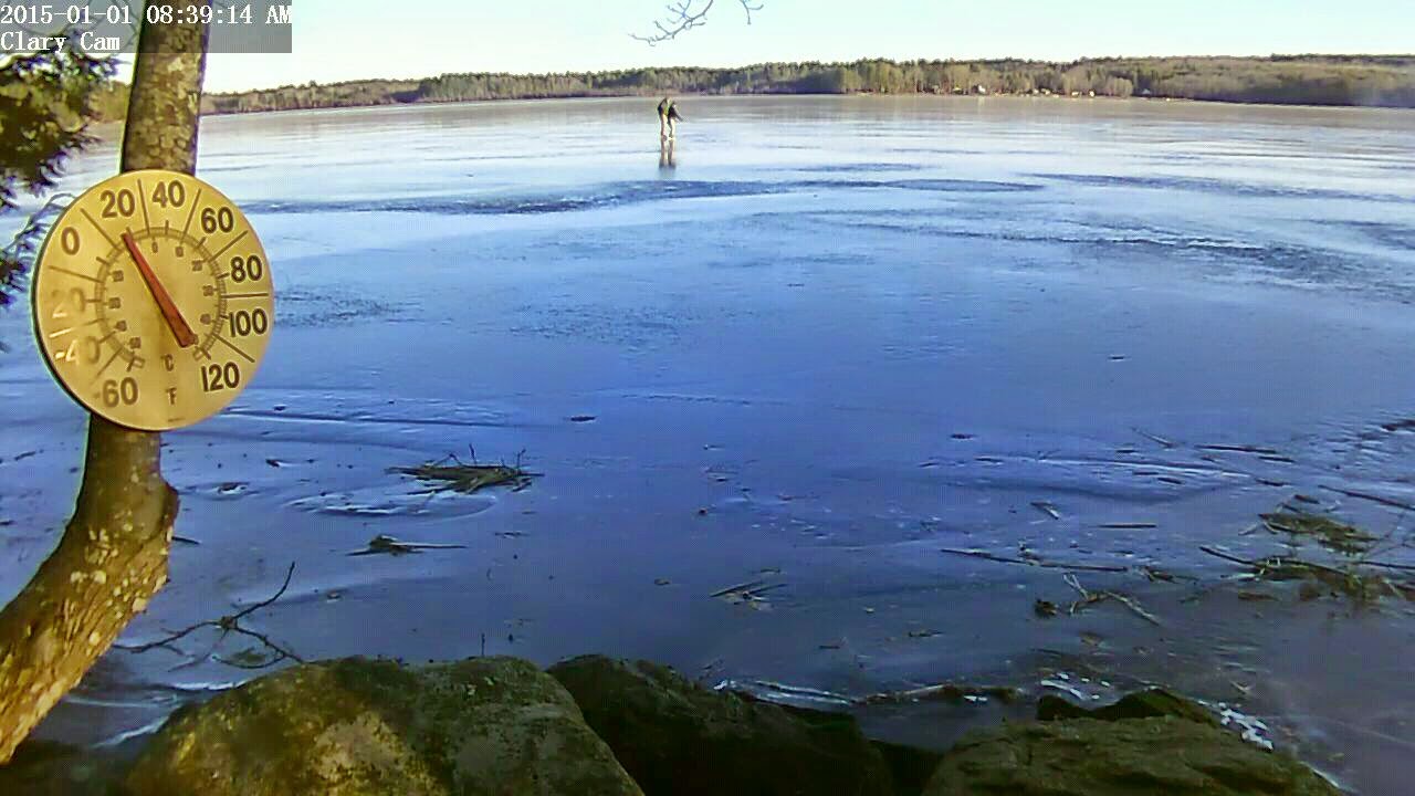 A couple of skaters cruised by the Clary webcam this morning. It’s a chilly 17° out there making for some “hard” ice but fortunately there’s no wind. I’m going to head out myself in a few minutes and give it a whirl. The ice looks pretty good for the most part, but there appears to still be some open water over on the north shore out in front of the Duncan and Enos properties so if you head out skating, beware.
Incidentally, I’ve added a Winter 2015 photo album.