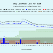
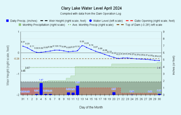
 I have archived the April 2024 water level chart (above, and at left). April was another wet month, though not nearly as wet as March had been: we received 4.62 inches of rain, 3/4 of an inch more than the 3.87 inches we’ve received in a “normal” year, whatever that means. Most of that rain fell by the 12th of the month, only a little over a half inch fell during the rest of the month. This allowed the ground was to dry out a bit. For the year we’re at 20.58 inches of precipitation, a little more than 7 inches above average for this date. This bodes well for ground water supplies later this summer. All this water has kept the lake level generally higher than we like: March actually ended with the lake level 0.31 feet above the High Water Mark or fully 6 inches ABOVE the lowest spot on the top of the dam. When the lake is that high, there is a real risk of shoreline erosion in areas around the lake that are not protected by a rocky shoreline. However, managing the dam to maintain a specific lake level is a real challenge and the response to a change in gate opening or weir height can be maddeningly slow. It’s too easy to over shoot the mark, or fall short of it. Therefore, we try to avoid large gate and weir adjustments and take some time to bring the lake level up or down where we want it.
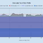
 We spent the first 3 weeks of April gradually bringing the lake level down to around the top of the dam or thereabouts and we were able to keep it around that level for the rest of the month. The top of the dam is neither flat nor level and when the lake level is at the official HWM established by DEP back in 2014 (151.17 feet) all but 2-3 high spots on the dam are under water. So there’s about 3 inches of water at the top of the 2 feet of water we get to play with during the year that’s actually impossible to manage at all… because it just runs over the dam and disappears downstream. For this reason in the spring and early summer, we don’t bother trying to maintain the lake level at the High Water Mark but aim for keeping the lake at its “full capacity” with a lake level right around the top of the dam, give or take a few inches. The chances of getting DEP to consider changing the elevation of the high water mark to something more reasonable are slim to none. Changing an adjudicated water level order just isn’t going to happen.
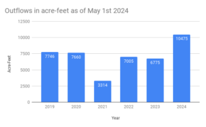
 Outflows from Clary Lake this year continue to exceed those of the previous 5 years by a significant amount, as shown by the chart at left. More water actually left the lake in April than can be accounted for by rainfall alone; a good deal of groundwater stored up from earlier in the winter seeped into the lake and helped offset the falling water level. This is actually a good thing because heavy rains wash sediment into the lake bringing with it Phosphorus which feeds algae. Currently, residence time is the shortest we’ve ever seen it (83 days) meaning water isn’t hanging around in the lake very long before reaching the dam and heading downstream to the Sheepscot River. It remains to be seen what effect this flushing effect is going to have on water quality later this summer but if last year is any indication, it should be fine.

