 Every fall after the water quality monitoring activities end for the year (see “2016 Water Quality Monitoring Season Concludes“) I make a point of updating the Transparency and Total Phosphorus charts for Clary Lake, posting them on the website, and writing about them. I also share them with the Maine VLMP and the Maine DEP. These graphs now depict 41 years worth of data collected by certified water quality monitors from 1975 through the end of the just-ended 2016 season. Both graphs continue to show alarming trends, toward higher phosphorus levels and lower secchi disk readings. These trends are familiar to us, and go hand in hand: phosphorus feeds algae whose rapid growth reduces transparency. When transparency drops below 2 meters, you’ve got a bloom. As phosphorus levels trend up, transparency trends down. The trend lines of both graphs are clearly influenced by data from the last 10 years, and in particular, from the last 5. And we all know what’s been happening to Clary Lake over the last 5 years.
As mentioned, secchi disk readings below 2 meters (6.6′) signify an algae bloom in progress. As you can see from the above chart, prior to 2009 we didn’t record any secchi disk readings below 2 meters. In 2009 we experienced a severe algae bloom- Clary’s first- with secchi disk readings of 1.60m on 8/28/09 and 1.25m on 9/11/09. I don’t have any record of lake levels for that summer, but it was an exceedingly wet summer season with 22.9″ of rain recorded in Augusta for the 4 month period May, June, July, and August. That’s over half the average yearly rainfall, received in just 4 months. This would have resulted in significant runoff and undoubtedly played a major role in the algae bloom that summer.
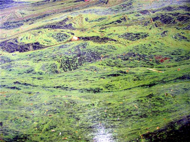
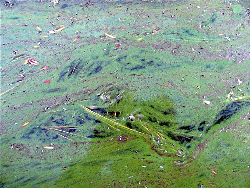
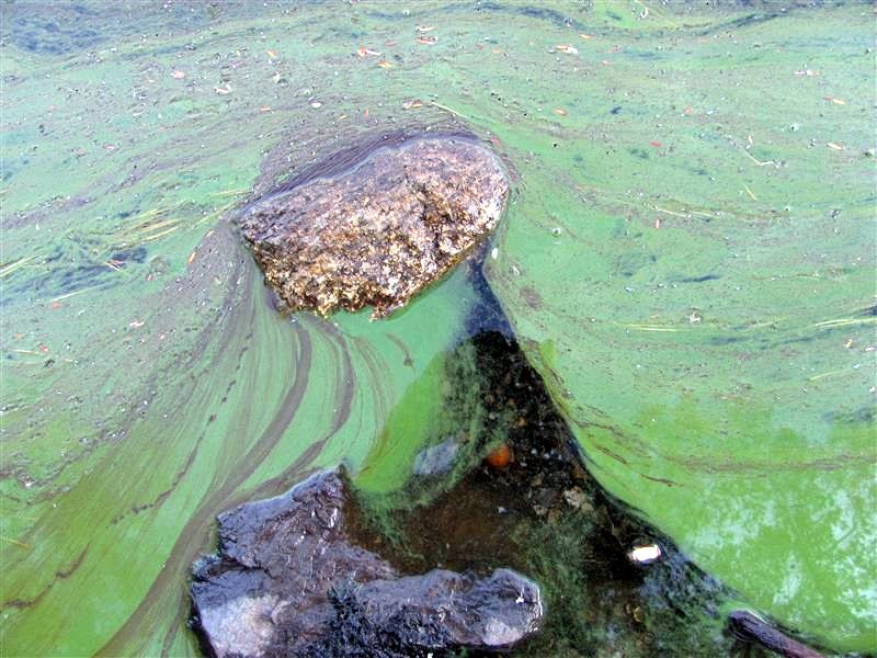
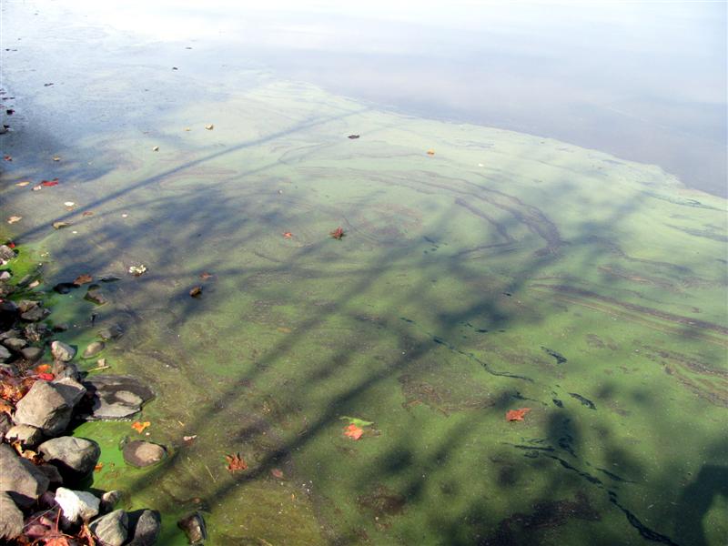
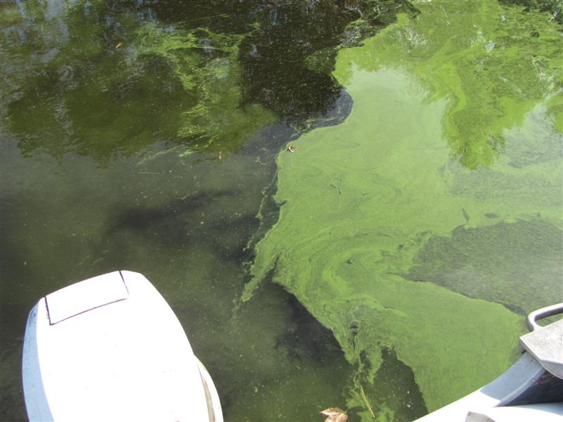
Since then, we’ve experienced algae blooms to a greater or lesser extent 4 out of the last 6 years, with the worst one being in the late summer and early fall of 2013. There was no bloom in 2010 or 2016. Some of you will remember these pictures from Fall 2013:
There can be little doubt that the low water conditions have been a primary cause of our declining water quality in recent years. Low water results in reduced lake volume, a lower flushing rate, drained wetland areas, and overall higher concentrations of nutrients.
The Total Phosphorus chart at left shows a significant rising trend which is especially troubling because lake water quality is very sensitive to even small changes in Phosphorus content. It doesn’t take a lot of phosphorus to spur the growth of algae and plants. While it is hard to pinpoint the start of the up trend, clearly by the mid-1990s it was well underway. The average Total Phosphorus value from 1975 through 1999 was a modest 0.016 mg/l (granted, there isn’t a lot of TP data during this period to average). Over the next 10 years from 2000 through 2010 the average had risen +0.04 mg/l to 0.020 mg/l, a huge change, relatively speaking. In the last 5 years from 2011 through 2016 the average has risen an additional +0.01 mg/l, to 0.021 mg/l. These are impressive changes with potentially severe impact on Clary Lake water quality. If this rising TP trend continues (and I see no reason why it won’t) we can look forward to more, more frequent, and more severe algae blooms in the future. Given that TP levels above 0.015 mg/l can result in abnormal algae growth and the possibility of an algae bloom, we’ve got a big problem that even quick restoration of the historical water level of Clary Lake won’t solve. However, without restoration of the historical water level of Clary Lake AS SOON AS POSSIBLE, there is little hope for anything but a further decline of Clary Lake’s water quality.
Low water conditions can contribute to rising phosphorus levels in various ways including soil erosion and sedimentation of bottom sediments around the lake edges exposed to rain and wave action. Additionally, the draining of wetlands areas which normally act as a “sponge” to soak up nutrients can cause more of those nutrients to end up in the lake water. However, rising TP concentrations clearly predate the current water level crisis visited on Clary Lake since 2011 so clearly, we’ve got a problem above and beyond the lake level. We need to look for other sources of Phosphorus as well.
Typically it is development within the watershed that is to blame: buildings, driveways, parking lots, and other impermeable surfaces that prevent rain from soaking into the ground but instead allow it to runoff into lakes. Phosphorus transport mechanisms are well known. The primary source of phosphorus in lakes is from what are referred to as non-point sources of pollution that result in soil erosion and sedimentation. Typical non-point sources of pollution are gravel roads and driveways with poor drainage, poorly designed or poorly maintained culverts, lawns, roadside ditches that allow water to gain speed and erode soil, even such innocuous sources of erosion as drip lines under house eaves that result in sediment-laden runoff. Concerned with rising phosphorus levels back in 2001, the Clary Lake Association conducted a Watershed Survey specifically to identify and mitigate non-point sources of pollution within the Clary Lake watershed. 90+ sites of NPS pollution were identified during the survey. The Watershed Survey Report is well worth reviewing. The watershed survey is overdue for an update.

